Kalisz Pomorski 2019-06-21
Jaworze airport near Kalisz Pomorski.
Geographic coordinates: 53.311N 15.712E. Elevation 346 ft.
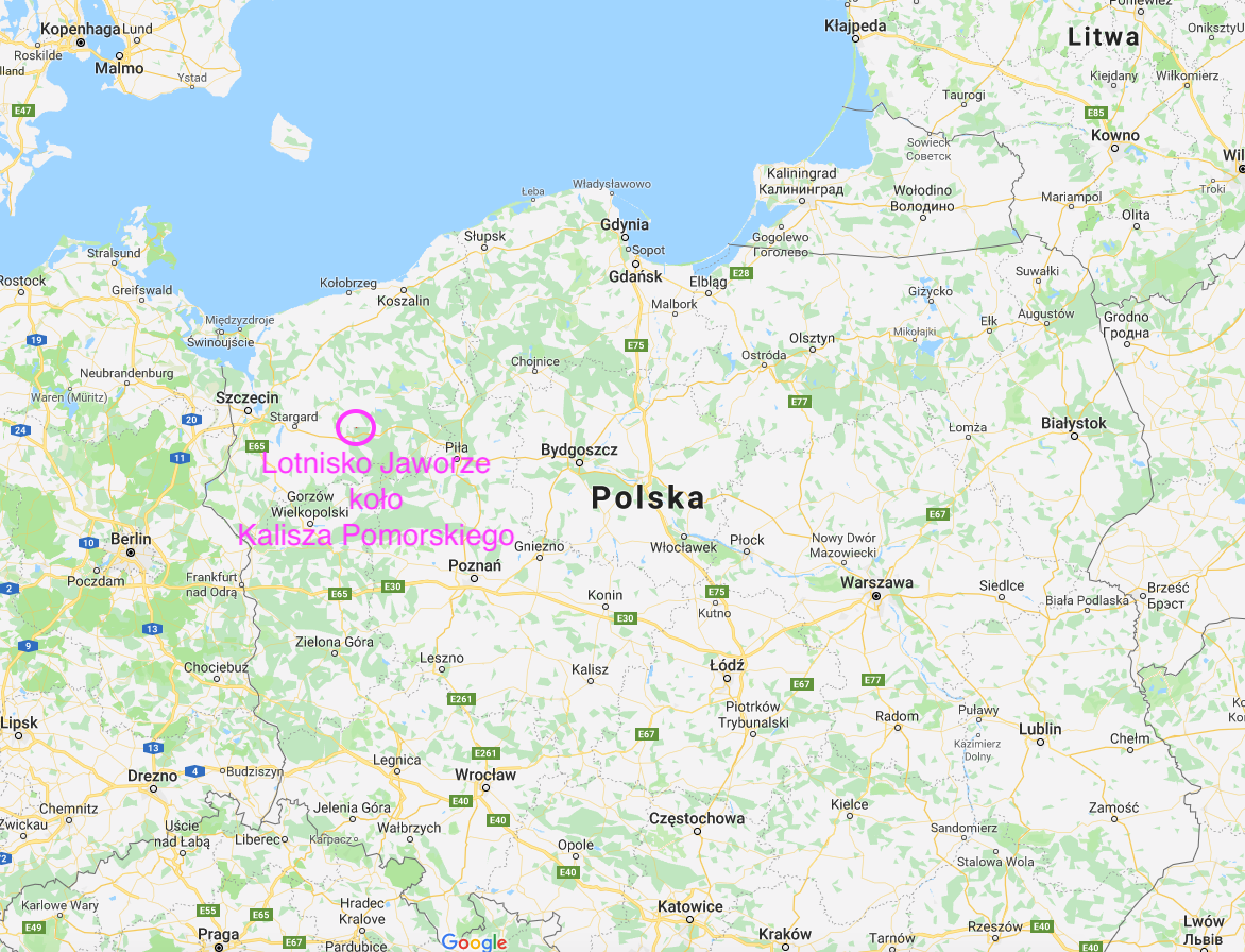
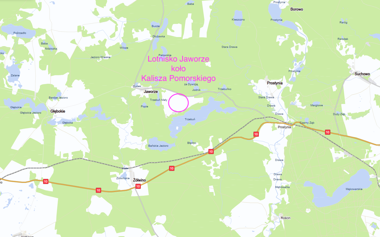

There are five towns in Poland named Jaworze. The one we are interested in is located in the West Pomeranian Voivodeship in the Drawski District in the Kalisz Pomorski Commune (Sołectwo Prostynia). Geographic coordinates 53°18′59″N 15°41′26″E. Jaworze lies to the west of Kalisz Pomorski (about 15 km) and Prostynia (about 6 km). Although the National Road No. 10 (Piła-Szczecin) runs near Jaworze, access to the village is only by narrow local roads. Access by rail is also problematic. You can come from Kalisz Pomorski by train (line No. 403) to Zółwino, and from there it is still 3.5 km to the airport, and 4 km to Jaworze.
The village was probably founded in the 18th century and was located in Germany. In the 1930s, a huge training ground was established in this area, which was later named Drawski Training Ground. This led to the displacement of some inhabitants. Many military facilities were built on the territory of the training ground. Among other things, the airport was located among the forests, near Lake Trzebuń. It was given the name Gabbert. It is assumed that the airport was opened in 1937 or 1938.
In 1939, the Germans used the airport to attack the Republic of Poland. Heinkel He 111 and Messerschmitt Me-109 aircraft took off from the airport. The airport was intensively used in the period from 1939-09-01 to 1939-09-10. On 1939-09-11, air units were moved to the east, with the front.
After World War II, the world's greats decided that Zachodnio-Pomorskie was assigned to Poland as the Recovered Territories. The entire area of the Drawsko Military Training Area remained a blank spot on the maps of Poland. The village of Jaworze was not intended for settlers. The right to live was granted only to the forester with his family, who had a telephone line connected in the 60s. It was the only civilian phone in the area. Several settler families took over the houses of the natives, but they never gained the right to register.
In the 1960s, local roads were often run over by tanks, which from the Prostynia railway station, after unloading from the echelons, went to the training ground.
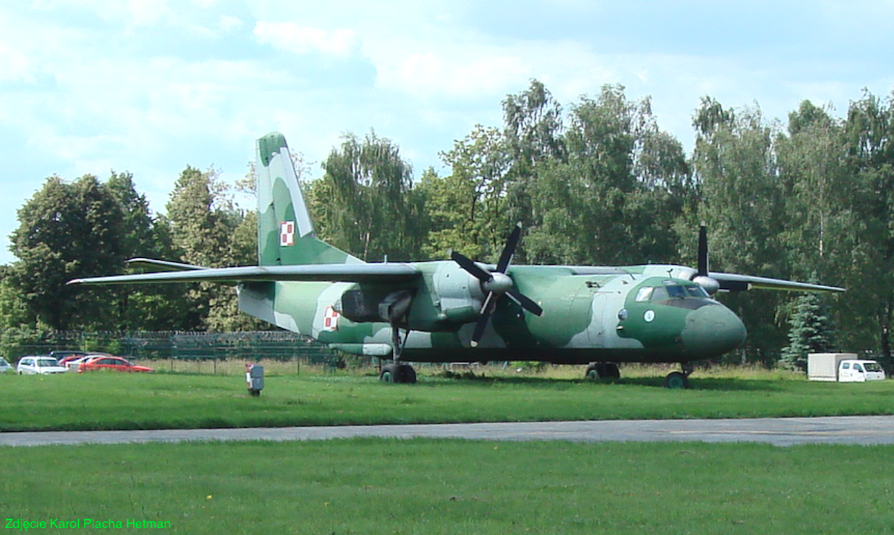
In the 1960s, the airport was occupied by the Polish Army Aviation. Several facilities were built: a staff and barracks building, a warehouse, a carport, and a fuel and lubricant storehouse. Helicopter and transport units were temporarily based here. Mainly PZL An-2 aircraft landed here. Helicopters from the 37th Regiment of Transport Helicopters from Leźnica Wielka were based here. In the 70-80s of the 20th century, the airport was under the command of the unit in Balice, the 13th Transport Aviation Regiment.
At the end of the 1960s, a holiday resort for military personnel and their families began to be organized on Lake Trzebuń. Later, the center was transformed into the "Wilga" Military Holiday Home. WDW "Wilga" became famous during martial law, when it became a place of internment of some selected oppositionists. VDW "Wilga" was a center of "exchange of experience" between the communists and the "independent" opposition. Interned here (or rather rested) were, among others: Bronisław Geremek, Bronisław Komorowski, Stefan Niesiołowski.
In the 90s, Jaworze appeared on the maps. In 2007, the village had 5 inhabitants.
There are several lakes in the area. Their waters are clean and therefore a paradise for anglers. The largest is Lake Trzebuń. From this lake in 1999, a German Messerschmitt Me-109 fighter was extracted, which crashed after taking off from the airport in Jaworze in 1939. The plane was restored. It is possible that there are other planes at the bottom of the lake. It should be remembered that soldiers are still training in these areas. Therefore, the roads are periodically closed.
The Jaworze airport.
Geographic coordinates N53°18'41.7" E15°42'42.7".
Elevation 346 ft.
Marked as an airstrip on aeronautical charts, and a difficult one at that. Grass not mowed. It should be treated as an emergency landing site. Not used by the Polish Army since the 1990s.
Written by Karol Placha Hetman