Piotrków Trybunalski. 2023-07-07
Piotrkow Trybunalski railway station.
Geographic coordinates: 51.411N 19.684 E. Elevation 203 m (666 ft).
Piotrków Trybunalski.
Piotrków Trybunalski is a city in central Poland. After World War II, the word Trybunalski was added to the name of Piotrków to emphasize the rich and beautiful history of Polish parliamentarism and democracy, because it was here that the Crown Tribunal had its office. One of the most beautiful court buildings in Europe is located in Piotrków Trybunalski. Piotrków Trybunalski is located in the Łódź Voivodeship and is a city with poviat rights. The city has an area of 67.3 km square. The population is 67,734 inhabitants (2022).
The city of Piotrków Trybunalski is located in the south-eastern part of the Łódź Voivodeship on the Strawa River. Historically, it is the Sieradz Land, which beautifully connected Lesser Poland, Greater Poland and Mazovia. It is 46 km from Piotrków Trybunalski to Łódź, 90 km to Częstochowa, 145 km to Warsaw, 170 km to Kraków, and 245 km to Poznań.
History of Piotrków Trybunalski.
The settlement was founded in the 8th century. The city received city rights between 1290 - 1300. Unfortunately, the first city documents of Piotrków were destroyed around 1400, when a great fire destroyed the city. In the 16th century, Piotrków was a royal town belonging to the Sieradz Voivodeship. In the period 1975 - 1998, the city was the capital of the Piotrków Voivodeship. From the thirteenth century, in the documents, the city was called Piotrków, Pietrków or Piotrkowo. The name comes from the name Piotr.
In 1217, in a document by Leszek the White for the Cistercian order in Sulejów, the name Piotrków is mentioned for the first time. In 1313, Władysław Łokietek described Piotrków as a town. In 1346, the Statutes of Piotrków were written down and the city became the seat of noble courts; land and townships. From 1442, synods of the Roman Catholic Church, Gniezno province, were held in Piotrków. In 1467, the Peace of Toruń was ratified in Piotrków. In 1468, the first general parliament of the Kingdom of Poland was held. On December 1, 1469, at the Diet, the Prussian Grand Master Henry Reuss von Plauen paid homage to Casimir IV Jagiellon. In 1492, the election of Jan Olbracht took place. In 1493, the Sejm was divided into the Chamber of Deputies and the Senate. In 1578, the Crown Tribunal for Greater Poland was established. The city developed rapidly. Many inns and inns were built. Horses were bred on a large scale. The craft developed.
The fall of Piotrków was brought about by natural disasters and the effects of wars with Sweden. A great fire in September 1786 destroyed the baroque buildings of the Old Town, which was rebuilt in the early 19th century, only the medieval urban layout and historic churches remained. The former splendor of the city was maintained by schools run by the Jesuit and Piarist orders, where not only the Catholic faith was cultivated, but also parliamentarism and democracy, effectively opposing the harmful reformation.
In 1793, the second partition of the Republic of Poland took place and Piotrków was incorporated into the Prussian partition. In 1807, Piotrków was incorporated into the Duchy of Warsaw, and in 1815, into the Kingdom of Poland, completely controlled by Muscovites.
On September 2, 1846, the first train left the station in Piotrków in the direction of Warsaw. The construction of the railway line effectively contributed to the development of the city. A new modern center has been built between the old town and the railway station. Within a few years, the city's population grew to 40,000 inhabitants. New factories and craft workshops were established.
In 1914, with the outbreak of the Great World War, the city passed from Prussian hands to Muscovites several times, and finally, in December 1914, Piotrków was occupied by Austro-Hungary. On November 2-5, 1918, the Poles disarmed the Austrian occupiers. The Republic of Poland regained its independence.
On September 1, 1939, the Germans together with Muscovites attacked Poland once again. In the period of September 2-4, 1939, Piotrków was constantly bombed. About 200 residential buildings were destroyed. On September 5, 1939, the German occupation began. German bestiality against Polish citizens was enormous. The first ghetto for Polish citizens was created here. On October 26, 1939, the Germans incorporated Piotrków into the General Government, a state that aimed to eliminate the Polish nation.
On January 18, 1945, the Muscovites entered Piotrków and the Soviet occupation began, and Poland was organized along the lines of the CCCP. Soviet troops were stationed in Poland until 1993, but Soviet agents have remained until the present day.
Warsaw-Vienna Railway.
The Warsaw-Vienna Railway was established in the period 1840-1848 and was one of the first railway routes in the occupied (partitioned) Republic of Poland. The route was 310,400 km long and connected Warsaw - Piotrków - Częstochowa - Granica (now Maczki), in the corner of the three emperors. That is to the border with Galicia (Austrian partition). Next, the line ran through Mysłowice (under Prussian rule) and further to Vienna. In the other direction, the line ran to Kraków and then to Lwów. The manager of the railway line was the Warsaw-Vienna Railway Association. Importantly, the line was built with rail gauges of 1435 mm.
The line was built during the Muscovite occupation and was called Варшавско-Венская железная дорога, and in Polish - the Warsaw-Vienna Iron Road. The route was the first railway line of the then Kingdom of Poland and the second in the Muscovite empire (the evil empire). The Muscovites approached the railway lines from the point of view of military use, because they were never interested in economic development and the well-being of the inhabitants. Polish industrialists who wanted good communication with other industrial centers were involved in the development of the line.
Angle of the Three Emperors.
Angle of the Three Emperors, or rather three imperial countries, with barbaric tendencies towards other nations: Prussia (Germans), Austria (later Austria-Hungary) and Muscovites (Russia). This term functioned in the period 1846 - 1915, but in Polish it was called "Emperor's Privy".
The first important border changes in this area appeared in 1742, when as a result of the Austro-Prussian war, a large part of Silesia passed from Austria to Prussia. At that time, the Czarna Przemsza River became the border separating Prussia from the Duchy of Siewierski, which was a Polish fief. From 1790, after the Duchy of Siewierski was merged with Polish lands, it was the border with the Republic of Poland. This state of affairs changed during the 3rd partition of Poland, where the entire area was included in Prussia, and the borders of the three imperial powers in the period 1795 - 1807, i.e. from the 3rd partition of Poland to the creation of the Duchy of Warsaw, converged in the area of the town of Niemirów to shape in Czarna Przemsza in 1807, as a result of the Treaty of Tylża. In the period 1815 - 1831, after the Congress of Vienna (Dancing Congress), the borders of the Congress Kingdom, Prussia and the Republic of Krakow converged here. In the period 1831–1846, after the incorporation of the Kingdom of Poland into the Muscovite state as an autonomous province, it was the meeting point of the borders of the Muscovite state (Russia), the Germans (Prussia) and the Republic of Kraków. Then, after the latter was incorporated into the Austrian Empire, in the period 1846 - 1871, the borders between the Kingdom of Prussia, the Austrian Empire (from 1867, Austria-Hungary) and the Muscovite Empire converged there.
The name Kąt (Triangle) of the Three Emperors was created after 1871, when the Germans were unified and this place, still on the border of the Kingdom of Prussia, also became the border point of the German Empire. Border lines ran along the rivers: Biała Przemsza, Czarna Przemsza and Przemsza.
Granica przestała istnieć w tym miejscu w 1915 roku, kiedy państwa imperialne wzięły się za głowy i doprowadziły do wybuchu wielkiej wojny światowej i „Wychodek Trzech Cesarzy” przestał istnieć. Cały ten teren wszedł ponownie w granice odrodzonej Rzeczypospolitej Polskiej.
Myslowice railway station.
In 1836, on the initiative of industrialists and merchants, the Upper Silesian Railway Society (TKG) was founded. The main goal of TKG was to connect Upper Silesia with Wrocław by rail. In 1841, the company Oberschlesische Eisenbahn Aktien Gesellschaft was established, which in the following years built a standard-gauge railway from Wrocław to Mysłowice. Individual sections of the railway were built in different places and only in the final one line was created.
In 1846, the railway was brought to Mysłowice. A further goal was to connect Upper Silesia with Krakow and thus overtake the Austrians in this investment and reap financial benefits from the transport. The main commodity was hard coal, iron products and the benefits of relatively cheap rail transport. Almost all railway lines were built by private companies, which received numerous legal facilities that appeared in the Kingdom of Prussia. Among other things, there were facilitations in the purchase of land for railway lines and numerous tax reliefs. The government of the Kingdom of Prussia strongly supported the development of railway transport.
The railway transport of the army and supplies for it appeared a bit later, because initially the army saw a threat in the railway that the enemy could make a quick surprise attack. The army demanded that important military facilities be bypassed by railway lines. This view was strongly represented by Moscow. The nationalization of railways in Prussia resulted in the interest of the army in this type of transport.
Works on the line Wrocław - Mysłowice (a border town of the Kingdom of Prussia) and at the same time in Mysłowice lasted from 1842. On October 1, 1946, the railway station in Mysłowice was ceremonially opened and the inhabitants saw the first train. King Frederick William IV of Prussia was present at this ceremony. The station was terminal and had only two tracks and a turntable for steam locomotives. The station was then called Myslowitz, but the names Mysłowice Główny and Mysłowice Miasto were also used.
On the other side of the border, in Galicia (Austrian partition), the railway was built by the Krakowsko-Górnośląska company. In October 1847, the two lines were connected. As a result, it was possible to travel the entire line from Kraków to Wrocław. Communication between stations was provided by telegraph and cavalry on the so-called scepter.
The Prussian authorities sought to build a railway line from Mysłowice to Sosnowiec, Zawiercie and other towns. But Moscow was not interested in this plan, suspecting a trick. In 1856, a railway line from Mysłowice to Oświęcim was built. Mysłowice was developing, but other regions of Upper Silesia were developing even more dynamically, including the newly established Katowice.
Mysłowice became a tourist place where people came to see where the borders of three mighty empires meet: Germanic, Austro-Hungarian and Muscovite. For the Poles, they were only invaders.
Mysłowice also became an important center for emigrants. People who wanted to emigrate from Galicia and the Kingdom of Poland to America came to Mysłowice. In Mysłowice, the Germans organized an emigration office which issued special documents. Emigrants bought train tickets from Mysłowice via Gliwice, Wrocław, Berlin to Hamburg. In Hamburg, emigrants changed to ocean-going ships and sailed to America.
Line Warsaw - Border (Maczki).
Against this background, it is clear how much the construction of railway lines had an impact on economic development. Let us remember that a horse pulls a cart with goods weighing up to 1,500 kg. On the other hand, a horse will pull a wagon on rails with a weight of 3,000 - 5,000 kg. According to estimates, the narrow-gauge route, 10 km long, replaced the work of 100 horse teams. The cost of transport decreased by 50 - 60%.
The technical design of the line was created as early as 1835. Engineer Stanisław Wysocki was the designer of the trail. In 1838, the Joint Stock Society of the Warsaw-Vienna Iron Road was established. The first construction works began in 1840, on the Warsaw - Skierniewice section. At the same time, horse traction and steam traction were considered. In 1841, steam traction was finally chosen as more efficient and the track gauge was 1435 mm.
However, in November 1841, the work was stopped due to the lack of sufficient funds, and in May 1842, the Warsaw-Vienna Railway Company declared bankruptcy. On July 4, 1843, the government of the Kingdom of Poland established the Warsaw-Vienna Iron Road Authority and in 1844, the works were financed by the Loan Bank of the Russian Empire (Bank Polski). In November 1944, the section Warsaw - Pruszków was put into use. On November 28, 1844, the first official train, carrying the governor of the Kingdom of Poland, the bandit Ivan Paskevich, and invited guests passed through this section.
The next railway section Pruszków - Grodzisk Mazowiecki was put into operation on June 14, 1845.
In Warsaw, the Vienna Railway Station was built, which was ready in 1845. The station has not survived to the present day (2023). In its place, there is now the "Centrum" metro station.
At that time, work was already underway on the remaining sections of the trail. On October 15, 1845, the line was brought to Skierniewice and Łowicz. On September 2, 1846, the first train left the station in Piotrków in the direction of Warsaw. In the literature you can find information that the first train from Piotrków left in November 1846. It was the train that carried the governor of the Kingdom of Poland, the bandit Ivan Paskevich, as recorded in the chronicles. But it was not the first train in Piotrków.
On December 1, 1846, the section to Częstochowa was ready, and on April 1, 1848, the first train arrived at Granica station (Maczki, now in the Sosnowiec district).
27 stations were built along the route. It was then the longest railway line in Europe - 310.396 km, built by one company. From October 1, 1848, it was possible to travel by rail from Warsaw to; Krakow, Wroclaw, Bogumin. Travel to Vienna has been possible since 1856.
Already in the first years, the line received the first branches. In 1859, the first connection Ząbkowice - Sosnowiec was opened, which directly connected the Kingdom of Poland with Prussia (not through Galicia). In 1862, the connection between Łowicz and Aleksandrów Kujawski was opened. In 1865, another private company built a connection between Koluszki and Łódź (now Łódź Fabryczna).
The route brought good income, which allowed for the modernization of the infrastructure. Pine sleepers were replaced with oak sleepers, and iron rails with steel rails. This allowed the use of heavier locomotives and trains. The first wood-fired locomotives were replaced by coal-fired locomotives, which were heavier and had more tractive power. The route was mainly used to transport hard coal, wood, textiles and agricultural produce.
In the period 1860 - 1880, a second track was laid, which increased the capacity of the route and increased the safety of travel.
Until 1857, the operation of the railway was in the hands of the Moscow treasury. Then it was in the hands of Polish industrialists. In 1912, the route Warsaw - Border was nationalized by the Moscow authorities. In 1918, after regaining independence by the Republic of Poland, the route was included in the PKP - Polish State Railways.
Route: Warsaw - Pruszków - Grodzisk Mazowiecki - Żyrardów (Ruda Guzowska) - Skierniewice - Koluszki - Piotrków Trybunalski - Radomsko - Częstochowa - Poraj - Myszków - Zawiercie - Łazy - Ząbkowice - Southern Strzemieszyce - Border (Maczki).
Branches: Skierniewice - Łowicz (connector to the Warsaw-Kaliska Railway). Lowicz - Aleksandrow Kujawski. Koluszki – Łódź Fabryczna (Fabryczna-Łódź Railway). Zabkowice – Sosnowiec.
Currently (2023) the Warsaw - Vienna route is the railway line No. 1, which starts with a turnout at the Warszawa Zachodnia station, which is a junction station. There are railway lines No; 2, 3, 8, 20, 23, 42, 46, 85, 445, 447, 448, 784, 849, 850, 918, 919. At km 6,804 there is the Warszawa Włochy station. At 8 km of the line there is a viaduct, where railway lines No. 3 and 457 run overhead. Then there is the Warszawa Ursus passenger stop, and then the Warszawa Ursus Niedźwiadek passenger stop. Then the railway line passes under the national road No. S2, S8 (Polish Military Organization Avenue). Then, from the north, there is a railway line from Warszawa Gołąbki station. Then there is the Piastów railway station. At km 15,891, there is the Pruszków station. There are railway lines No. 447, 512 here. Then there are passenger stops: Parzniew, Brwinów, Milanówek. At km 29,548, there is the Grodzisk Mazowiecki junction station. There are railway lines No. 4, 447. Then there is the Jaktorów passenger stop, 35.032 km. This is where the Central Railway Main Line (line No. 4) disconnects, which at 37.700 km goes over the line No. 1. Then there is the Międzyborów passenger stop (at km 40.468). At km 43,141, there is the Żyrardów station. Then we cross the Pisa Gągolina River, and after a while we cross the national road No. 50 and the Sucha River. At km 50.033 there is a passenger stop Sucha Żyrardowska. At km 51.959, there is a passenger stop Jesionka. At km 55.404, there is a passenger stop Radziwiłłów Mazowiecki. We cross the Korabiewka River. At km 60.779, there is a passenger stop Skierniewice Rawka. Here is the end of a straight section of the line from Warsaw itself. At 62,000 km, there was a large Miedniewice station, which was liquidated. Lines No. 12, 529 come here. At 65.926 km. There is a junction station in Skierniewice. There are lines No. 11, 12, 529, 558 here. We cross the Skierniewka River. Then we have a railway triangle in the direction of Łowicz and Koluszki. Now begins a section of the trail that changes direction several times. We pass the Zwierzyniec River and there is a passenger stop Dąbrowice Skierniewickie, 71.355 km. Maków passenger stop, 75.372 km. Passenger stop Płyćwia, 80.131 km. Passenger stop Lipce Reymontowskie, 84.710 km. Only now the trail is heading in a southerly direction. Passenger stop Krosnowa, 89.822 km. Passenger stop Przyłęk Duzy, 92.345 km. Horn station, 95.723 km. Here is also the Rogów Towarowy Wąskotorowy station. The line crosses the national road No. 72. Wągry passenger stop, 99.610 km. Koluszki junction station, 105.194 km. There are numerous junctions in the direction of Łódź and Tomaszów Mazowiecki. There are railway lines No. 17, 534, 535, 536, 538 and slip road No. 537 with a viaduct over line No. 1. There is a viaduct with line No. 25, 107,700 km. There used to be a Bęzelin station here. Rokiciny passenger stop, 114.176 km. We cross the Wolbórka River. Wolbórka passenger stop, 123.535 km. Baby Station, 129.944 km. Railroad crossing with provincial road No. 716. We cross the Moszczanka River. Passenger stop Moszczenica, 133.825 km. Jarosty passenger stop, 138.545 km. We cross the national road (S8, 12, 74, 91), viaduct under the road. Piotrków Trybunalski junction station, 144.242 km. Junction line No. 24, 146.420 km. Milejów passenger stop, 150.389 km. Intersection with the national road No. 91. Rozprza station, 156.555 km. Passenger stop Luciążanka, 159.433 km. Passenger stop Wilkoszewice, 162.533 km. Gorzkowice station, 166.718 km. Passenger stop Gorzędów, 171.660 km. Passenger stop Kamieńsk, 175.004 km. Intersection with the national road No. 91. Gomunice station, 177.694 km. Dobryszyce passenger stop near Radomsko, 183.452 km. Radomsko station, 189.133 km. Intersection with national road No. 42. We cross the Radomka River. Beaver passenger stop, 194.756 km. We cross the Warta River. Widzów Teklinów station, 200.525 km. Jacków passenger stop, 202.758 km. Intersection with the national road No. 91. Kłomnice station, 208.201 km. Passenger stop Rzerzęczyce, 210.606 km. Intersection with national road No. 91. Rudniki station near Częstochowa, 217.700 km. Connecting to railway line No. 146, with viaduct, 221.963 km. Turnouts Wyczerpy, 222.755 km. Passenger stop Częstochowa Aniołów, 225.816 km. Intersection with national road No. 1. Intersection with national road No. 46. Junction station Częstochowa Osobowa, 229.745 km. There are railway lines No. 701, 703. Częstochowa Towarowa station, 232.527 km. Junction towards Częstochowa Stradom station. Passenger stop Częstochowa Raków, 233,500 km. There are viaducts here with slip road No. 703 and line No. 61, 235,600 km. Korwinów passenger stop, 239.158 km. We cross the Warta River. Poraj freight station, 245.850 km, and junction of line No. 155. Poraj passenger stop, 246.950 km. Passenger stop Masłońskie Natalin, 250.787 km. Żarki-Letnisko passenger stop, 254.088 km. Intersection with the provincial road No. 789. Myszków Nowa Wieś passenger stop, 257.525 km. Intersection with the provincial road No. 793. Myszków station, 261.016 km. Passenger stop Myszków Światowit, 263.442 km. Intersection with railway line No. 4 - Central Railway Main Line, 265.100 km, but not yet connected by turnouts. Myszków Mrzygłód passenger stop, 266.370 km. Passenger stop Zawiercie Borowe Pole, 270.300 km. Zawiercie junction station, 274.227 km. Turnouts connecting with line No. 4, 275.093 km. Track turnouts No. 214, 216. Crossing with a road - Bypass of Poręba and Zawiercie. Łazy freight junction station, 280.654 km. Other railway lines No. 154, 160, 186. Łazy passenger station. Wiesiołka passenger stop, 284.313 km. Viaducts with lines No. 154 and 160, 265.100 km. Chruszczobrod passenger stop, 286.557 km. Intersection with the provincial road No. 796. Passenger stop Dąbrowa Górnicza Sikorka, 289.202 km. Junction station Dąbrowa Górnicza Ząbkowice, 292.896 km. Other railways; 183, 133, 160, 186. Intersection with the national road S1. Passenger stop Dąbrowa Górnicza Pogoria, 295.726 km. Passenger stop Dąbrowa Górnicza Gołonóg, 296.726 km. Dąbrowa Górnicza station, 300.267 km. Passenger stop Będzin Ksawera, 302.077 km. Intersection with the provincial road No. 910. Passenger stop Będzin Miasto, 304.385 km. Bedzin station, 305.524 km. Intersection with the national road No. 94. Sosnowiec Główny junction station, 309.544 km. Other lines No. 62, 660. Turnouts in the direction of Sosnowiec Południowy station. The bridge over the Brynica River, and then the bridge over the Rawa River. Intersection with the railway line to Katowice Szopienice Północne station. Passenger stop Katowice Szopienice Południowe, 312.910 km. Intersection with the national road No. 79. Katowice Zawodzie junction station, 315.653 km. Intersection with the national road No. 86. Katowice junction station, 318.378 km. Final turnout 318.686 km. Other lines No. 656, 137, 138, 139, 713.
Difference from the original route Warsaw - Granica (Mączki); Junction station Dąbrowa Górnicza Ząbkowice, 292.896 km. Here the trail turns due south. At Huta Katowice there is a junction and the "Vienna" route turns east, only to turn south again after a while. The second branch leads to the Dąbrowa Górnicza Strzemieszyce station. The "Vienna" line intersects with the national road No. 94. Then it intersects with the Dąbrowa Górnicza Strzemieszyce - Dąbrowa Górnicza Wschodnia railway line. Then it crosses the Bobrek River and passes Sławków Forest. It intersects with the railway junctions of the Euroterminal Sławków. It reaches the village of Maczki and is at the Granica station. Here was the transshipment of goods from the Warsaw-Vienna railway to the Austro-Hungarian railway trains. When transport was improved and most of the goods were not reloaded, trains crossed the Biała Przemsza River and headed either to the Szczakowa station (to the east, towards Kraków) or to the Mysłowice station in the Prussian Partition (to the west).
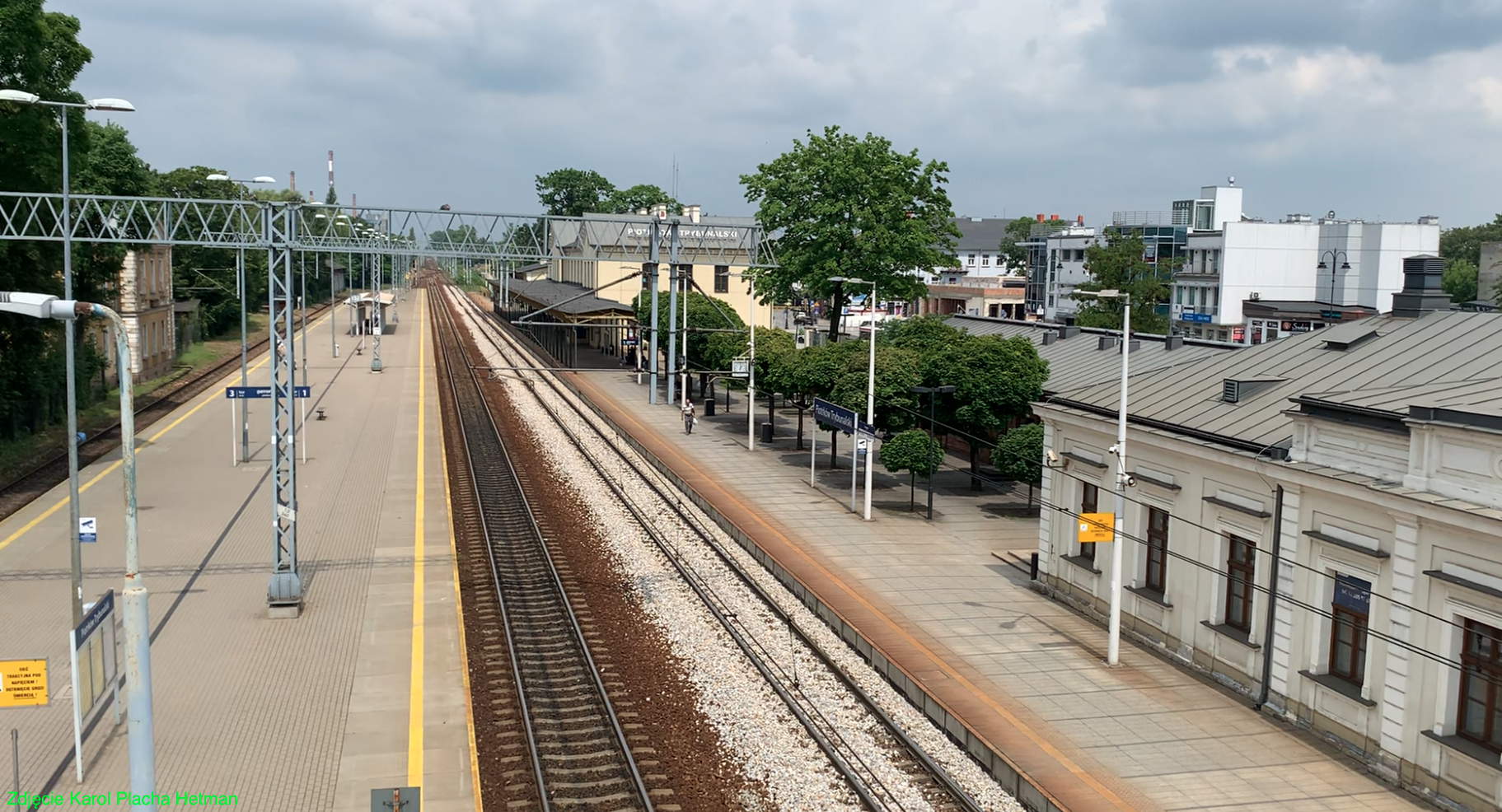
Piotrkow Trybunalski railway station.
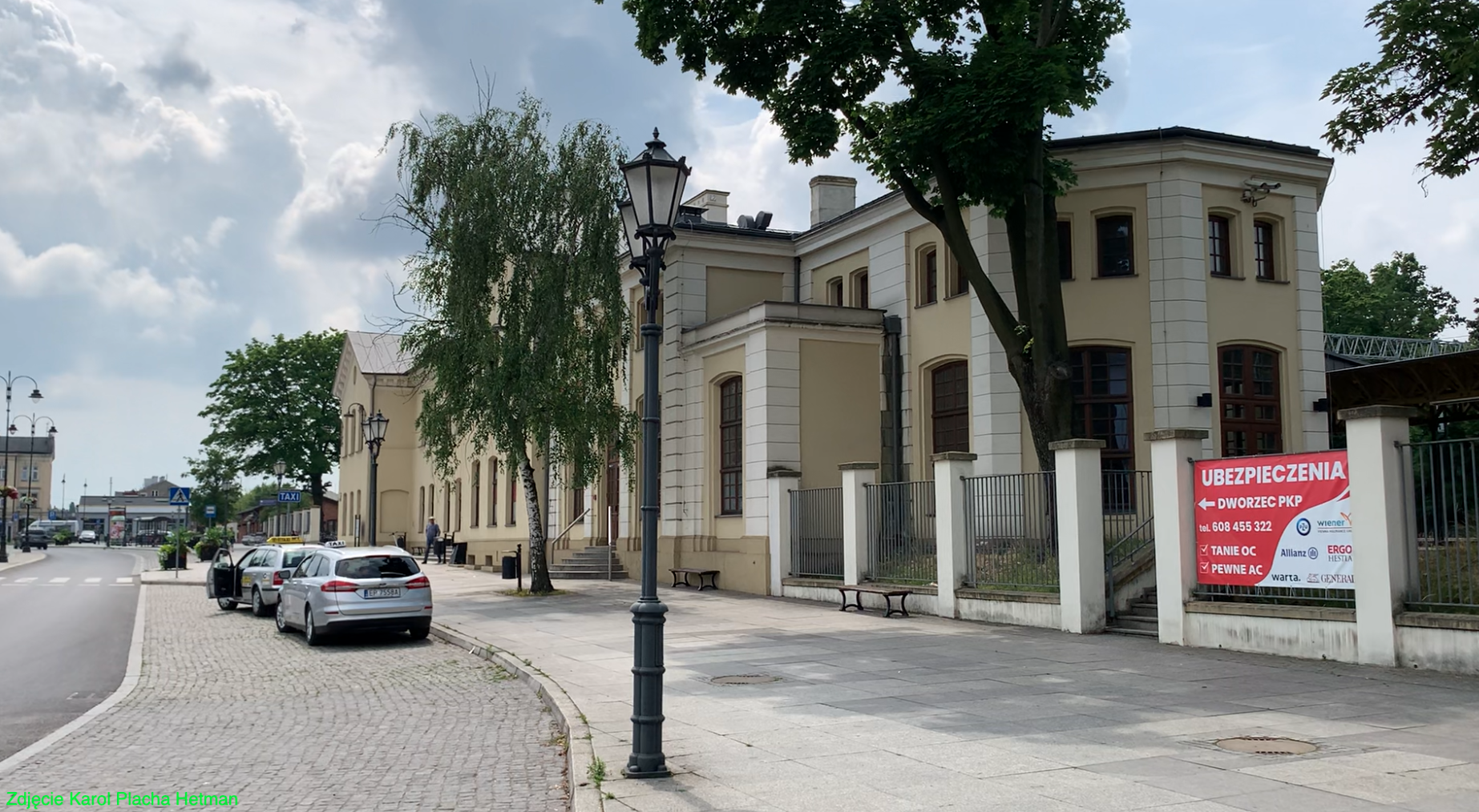
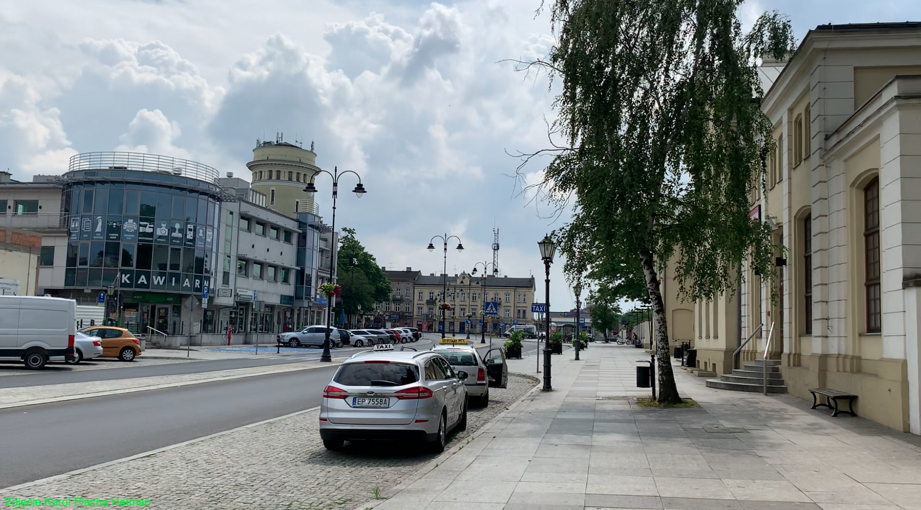
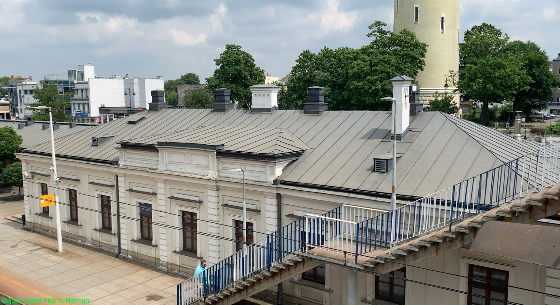
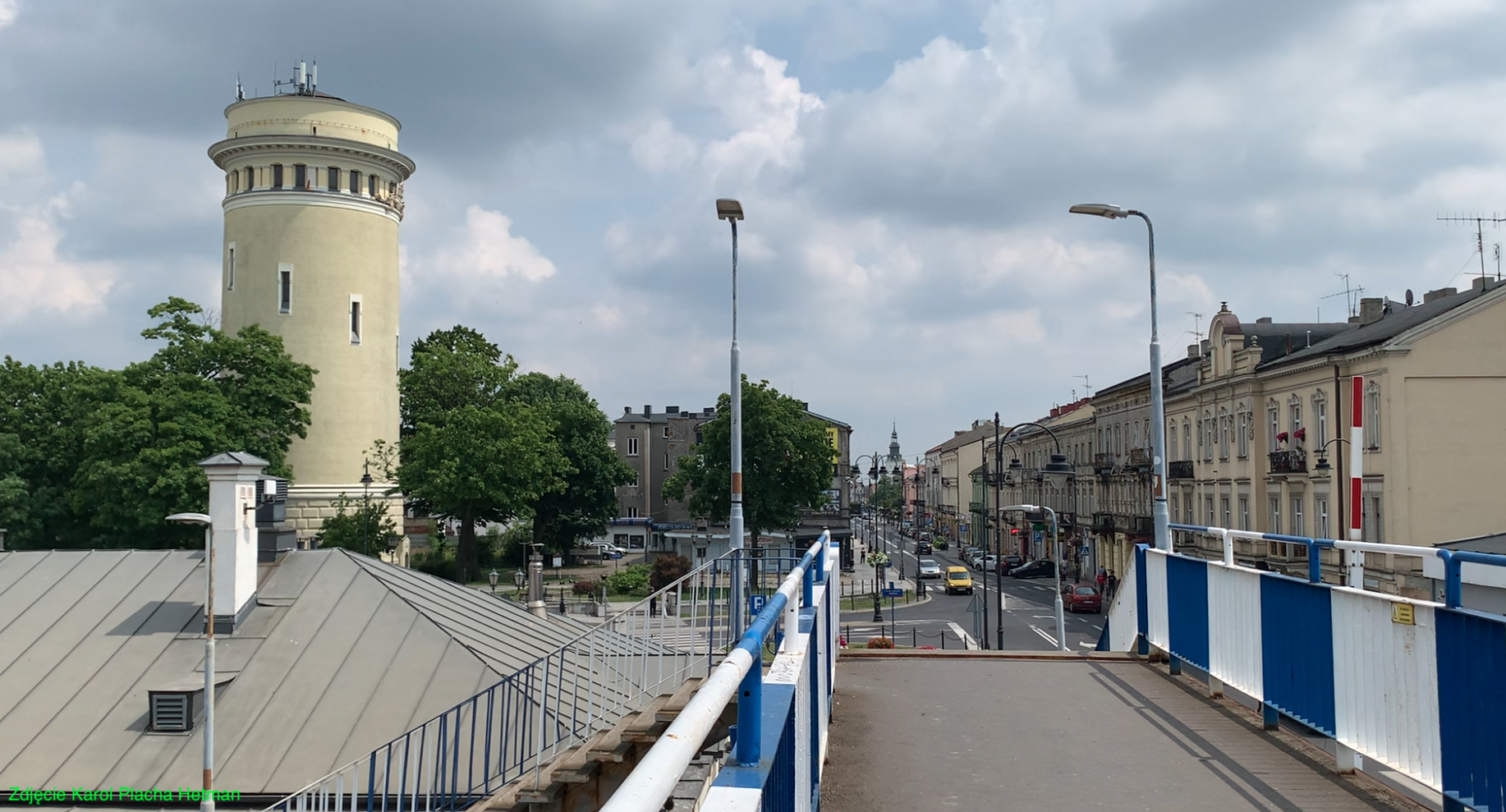
The Piotrków Trybunalski railway station was built to the west of the city center, 1.2 km from the Market Square. A railway station was built on the eastern side of the tracks, and technical facilities on the western side. A locomotive depot, workshop facilities, warehouses, administrative buildings, a forwarding building, and barbed wire for coal and wood were built. A little later, the locomotive depot was expanded to a fan layout. Currently (2023) the turntable no longer exists. There was also a water tower in the corner of the workshop building, and the building is preserved. A post office building and a goods loading ramp were also built. Most of these objects are on the list of historic buildings.
Many facilities at the station in Piotrków Trybunalski have been and are leased. Among other things, the building between the station and Juliusza Słowackiego Street, standing at Platform 1, which is built in the style of a manor house. The building is entered in the register of monuments. The facility has 220 square meters of usable space. The last renovation of the building was done in 2012. The property is equipped with electricity, water and sewage system (own sanitary facility). The building is heated by a gas stove.
During the Great World War the station was destroyed. Virtually only the walls remain. In September 1939, the station was destroyed again. The reconstruction of the station building was completed in the 50s. In the period 2010 - 2012, the station underwent the last general renovation. The ceremonial opening of the station after renovation took place on July 19, 2012. The station has retained its function, there are: ticket offices, waiting room, railway information, toilets, service outlets. The square in front of the station was very large and provided room for many cabs, carriages and carts. Currently, there is a transfer center here; railway, bus station, TAXI and numerous shops and service outlets.
The buildings on the western side of the tracks have been handed over to various companies that are not related to the railway a long time ago, in the 1990s. They are supervised by the provincial conservator of monuments. Next to the locomotive depot is a former workshop building, which has a water tower in the south-western corner. The entire area still belongs to PKP PLK.
The water tower at the railway station was built in the period 1925-1927, i.e. during the Second Polish Republic. The building is about 50 m high and is a monument of Polish engineering art. There were three water towers in Piotrków.
Several railway sidings were led from the station to nearby factories. On the western side there is a siding of the PKP Energetyka plant. The southern turnout head is a branch point for several sidings and a railway line towards Bełchatów.
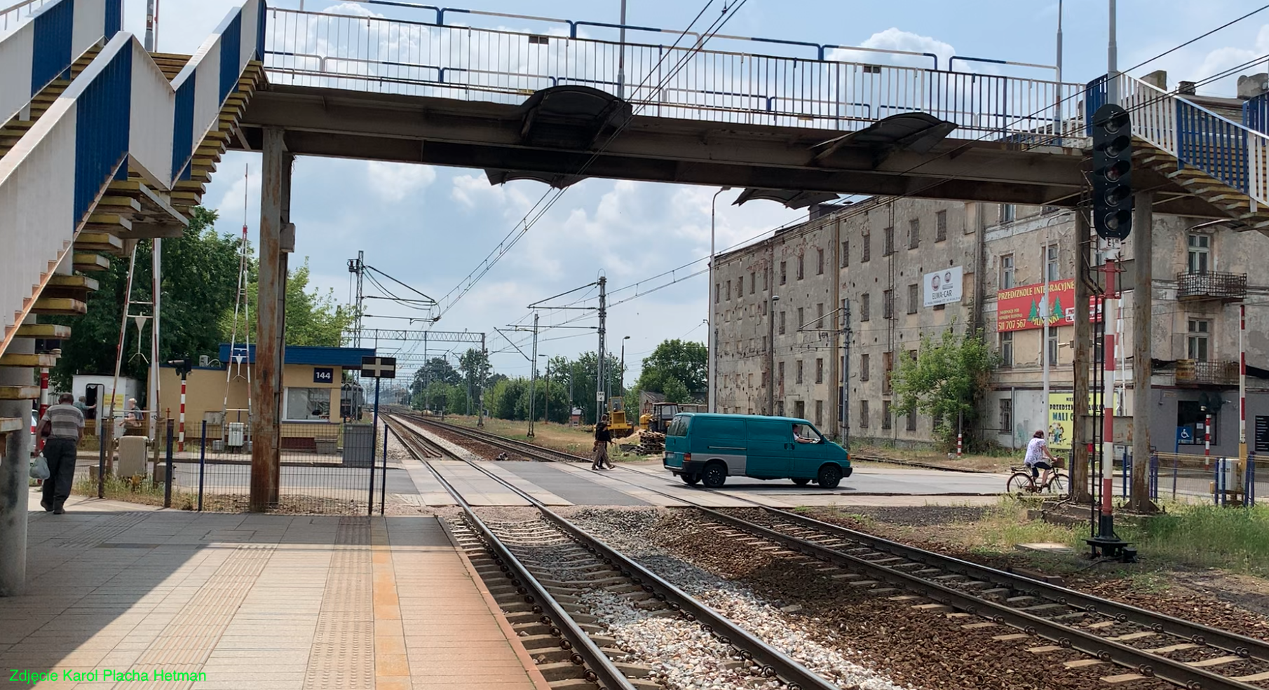
Currently (2023) the station has two platforms. Platform 1 at the station has a single edge and is 280 m long and 0.35 m high. Access to the platform is; from the station, station square, Juliusza Słowackiego street and from the footbridge over the tracks. Platform 2 is island-shaped and has a length of 285 m and a height of 0.55 m. Access to the platform is via a footbridge and Juliusza Słowackiego Street.
Due to the increase in glue traffic, in the southern direction, behind Aleja Marszała Józefa Piłsudskiego (provincial road No. 473), a freight station was built with a dozen or so tracks. A huge fan-shaped locomotive depot with over 20 stands was built here. Currently (2023) the depot is not in use. The turntable has been preserved. built; another water tower (on the north-eastern side of the locomotive depot), coal entanglements, numerous sidings, warehouses and railway service buildings. The entire area of the freight station stretches over a length of 1,375 m and covers an area of 343 hectares. The area closes with the following streets: Czarna, Franklina Roosevelta, Wolska, Złota and Górna.
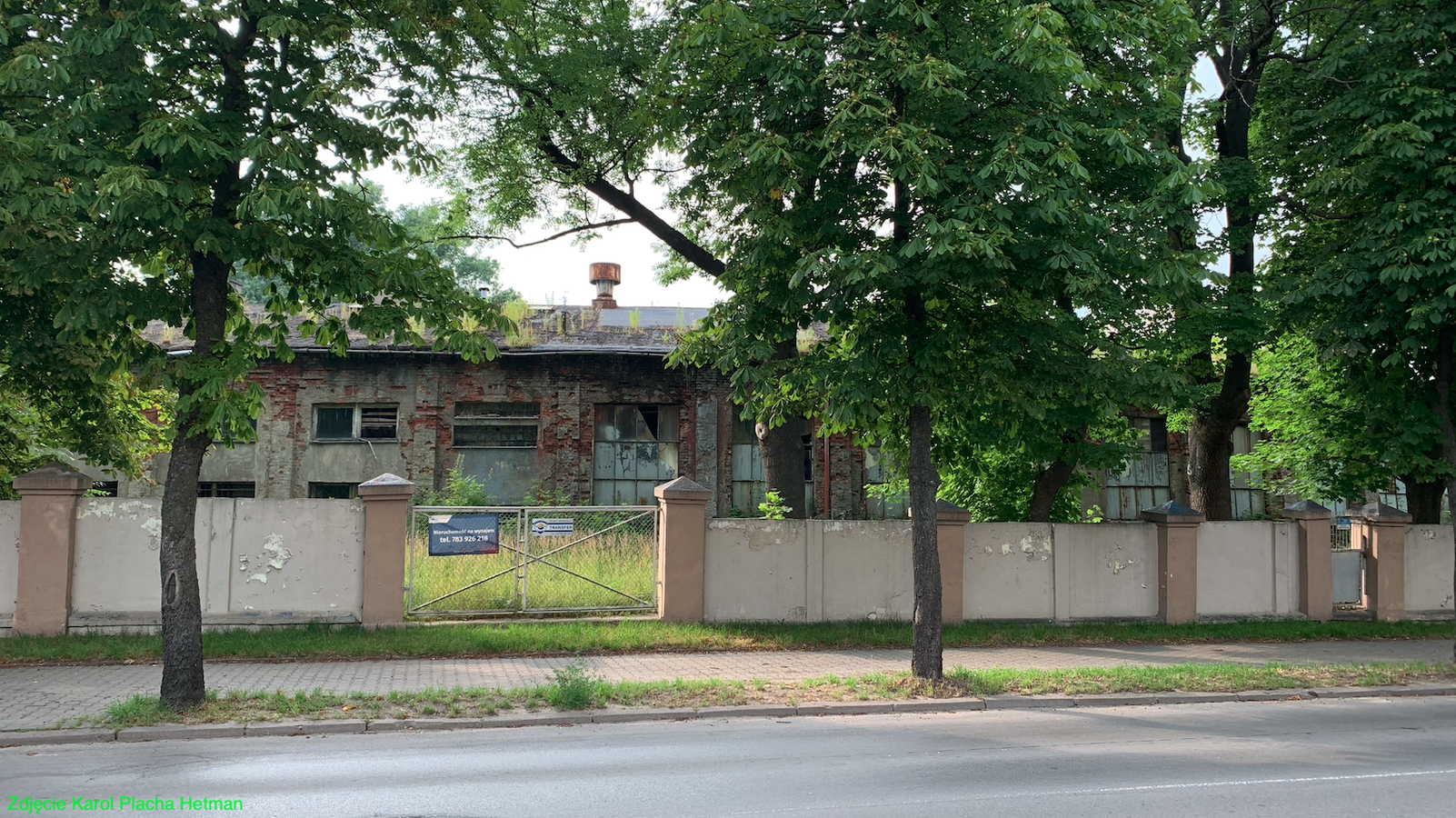
Photo description: Unused locomotive depot at a freight station. View from Franklin Roosevelt Street.
In the period 2013 - 2015, the modernization of railway line No. 1 was carried out. The track layout was changed. The subgrade and rails with sleepers and turnouts were replaced. One of the main-additional tracks in the passenger part was liquidated, and the island platform 2 was widened. Both turnout heads: northern and southern were simplified. Some redundancies have been removed. The traction network was also modernized, some poles and the traction network were replaced.
Railway traffic control is carried out by the "Pt" and "Pt2" control boxes. They use mechanical devices, centralized with traffic lights. Most of the traffic lights have been replaced and adapted to the new track layout. All main turnouts have electric drives. As part of the modernization, liquidation of the "Pt1" signal box.
Piotrków Trybunalski station is currently (2023) a station of regional importance with a large passenger and freight traffic. In the last 5 years (2017 - 2021), the station served from 550,000 to 805,000 passengers per year.
In June 2023, 69 passenger trains departed from the Piotrków Trybunalski station to: Białystok, Bielsko-Biała Główna, Częstochowa, Gdynia Główna, Hel, Katowice, Koluszki, Kołobrzeg, Kraków Główny, Krynica-Zdrój, Lublin Główny, Łeba, Łódź Fabryczna, Łódź Kaliska, Olsztyn Główny, Płock, Racibórz, Radomsko, Szklarska Poręba Górna, Eastern Warsaw, Wrocław Główny, Zakopane.
Railway line No. 24.
The discovery of lignite deposits in the Bełchatów region took place in December 1960. At that time, the search for natural gas was carried out. In the town of Piaski, deposits of coal deposits were found. In connection with the construction of a lignite mine and power plant, a railway line No. 24 was built; Piotrkow Trybunalski - Belchatow. The line was established in 1977. The first project of the line was created in 1973, and the line was to run from Piotrków Trybunalski through Bełchatów and Zarzecze to the Osiny station. There were plans to electrify the line. In distant plans, line No. 24 was to become a fragment of the Lublin-Wrocław trunk line (Opoczno-Oleśnica section). In 1977, the course of line No. 24 was corrected and moved more northwards; Piotrkow Trybunalski - Belchatow - Bialy Lug. The line was finally opened to traffic on November 10, 1977. Some of the railway sidings are owned by PGE Górnictwo i Energetyka Conventionalna and are not controlled by PKP PLK.
Current line No. 24: Starts at Piotrków Trybunalski station. The branch junction is at km 2,178. Passenger stop Wola Krzysztoporska, 11,650 km. Bogdanów passenger stop, 16,600 km. Belchatow station, 24,350 km. Passenger stop Miasto Bełchatów, 26,600 km. Zarzecze is a point of another owner's line - PGE Górnictwo i Energetyka Conventionalna.
Piotrków Trybunalski - narrow-gauge railway.
In the period 1902 - 2008, the Piotrkowska Narrow-Gauge Railway operated. In the area of Piotrków Trybunalski, the line began and led to Sulejów. Currently, only the area of the narrow-gauge railway station has been preserved.
Written by Karol Placha Hetman