Poznań 2014-10-07
Former military reserve airport Kąkolewo.
Geographic coordinates: 52.235N 16.241E. Elevation 90 m.
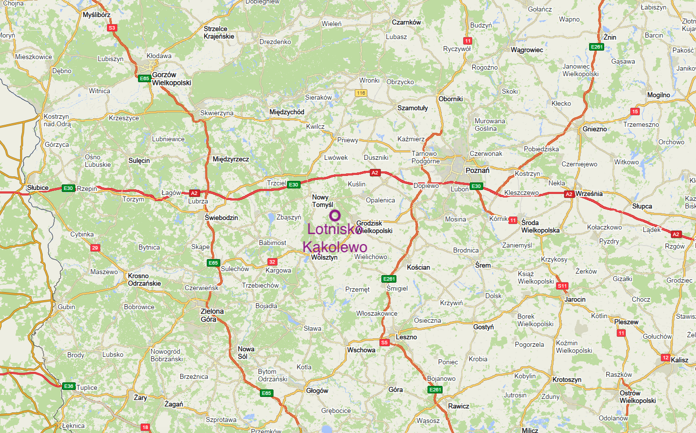
The town of Kąkolewo.
Kąkolewo is a town in the Republic of Poland, located in the Greater Poland Voivodeship, in Grodzisk County, in the Grodzisk Wielkopolski Commune. It is only 5 km from Kąkolewo to Grodzisk Wielkopolski. The first mention of the town dates back to 1415, when the town was called Kankolewo. The rights of the Olęder settlement were granted by a privilege of October 10, 1720. Around 1880, a brick Evangelical church was built here in the neo-Gothic style. In 1945, the church became a Catholic Church, dedicated to the Immaculate Heart of Mary. However, the parish was established here only in 1974. Inside the temple there is a polychrome made by the painter Witold Siwiński in 1963. In the period 1975 - 1998, Kąkolewo was administratively located in the Poznań Voivodeship. In addition to the temple, the attraction of the town is the linden tree growing next to the church, the circumference of which is 4 meters. The local inhabitants were engaged in agriculture. Life was slightly better here during the operation of the military airport. Currently (2014), Kąkolewo, located far from communication routes, is a poor and dying settlement. It is difficult to attract holidaymakers here, even though the distance from the center of Poznań is only 55 km.
Kąkolewo Airport.
Geographic coordinates of the airport: 52°14′04″N 16°14′39″E / 52.235N 16.241E. The runway is located in the direction 10/28 (106/286). Airport facade; 90 m (300 ft).
Kąkolewo Airport is a typical Cold War airport, built after the outbreak of the Korean War. Currently, it is difficult to determine the exact year of the airport's establishment. This time is estimated at the period 1955 - 1957. The airport was built as a typical use for fighter aviation. The airport was immediately designated as a backup airport for the 62nd PLM from Krzesiny. Access to the airport was provided by an asphalt road from Grodzisk Wielkopolski. The road to the village of Kąkolewo was paved. It must be admitted that the location, as a military airport, is very good. Agricultural land and part of the forests were intended for the facility. On the south side, a 100 m wide strip was planted with trees. A hardened RWY with a concrete surface was built in the uptake field. Originally, the RWY had dimensions of 2,000 m x 30 m. After the MiG-21 fighters were introduced into the Polish Military Aviation equipment, the runway was extended by 250 m towards the west and for the entire period it had dimensions of 2,250 m x 30 m. On the northern side of the take-off field, the main taxiway with three connectors. PPS was also built; western and eastern. From time to time (6-9 years), the surface of RWY and DK was renovated. The last renovations were carried out by laying an asphalt surface.
Almost all the time, there was a LSR station at the airport, and in the eastern direction there was a closer radio beacon (about 1,000 m) and a distant beacon (about 5,000 m, already in Grodzisk Wielkopolski). Both landing approach directions were supported by APM searchlights. Łucz expandable sets were used to illuminate RWY and DK.
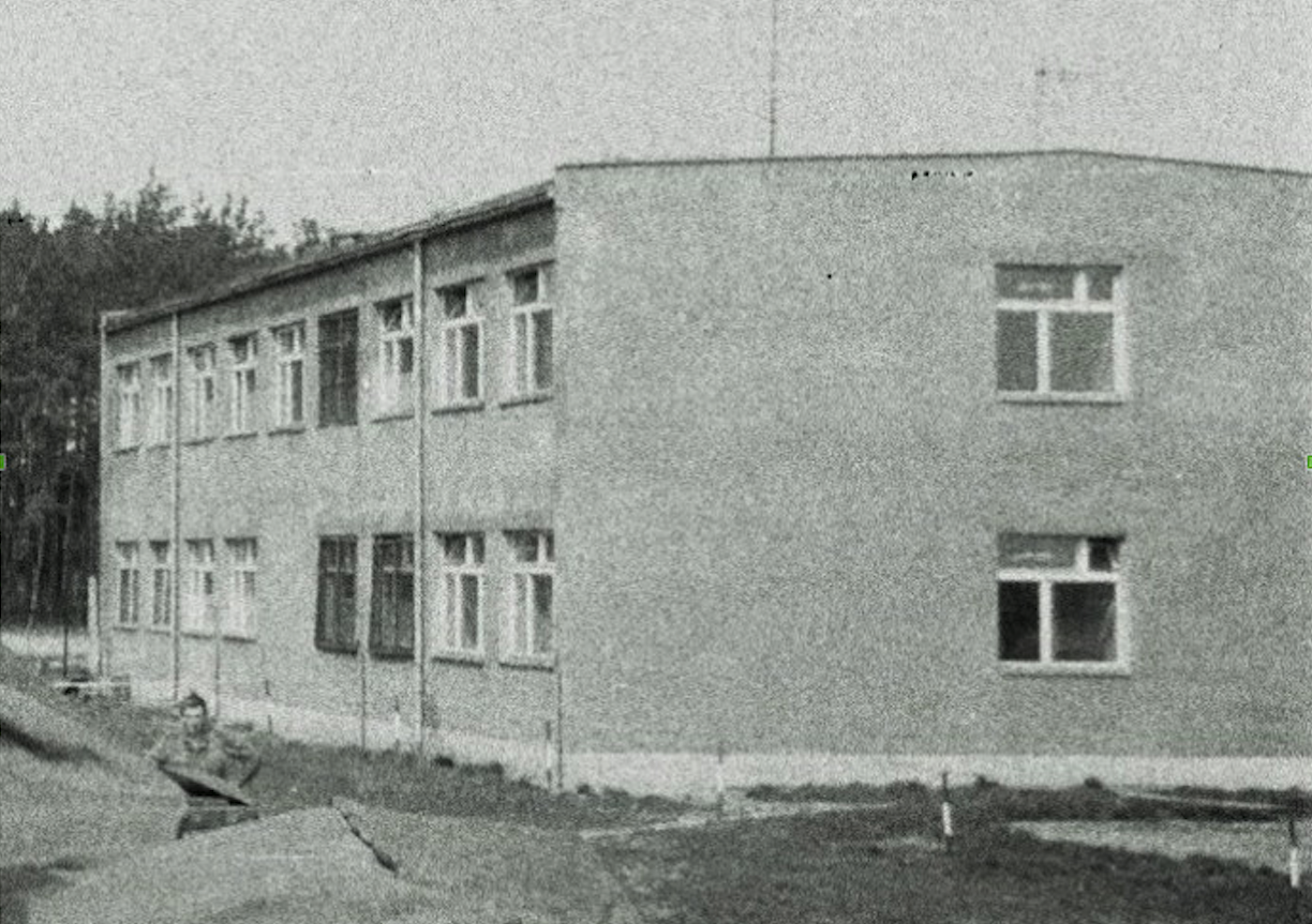
The airport's facilities are located in the forest, between the center of Kąkolewo and the take-off field. Here, in the 1960s, a two-story barracks was built and occupied by soldiers. After the 62nd Regiment relocated, the pilots were accommodated in the barracks. Conscript service soldiers lived in tents. Other officers lived on private stations. The army rented entire residential houses for officers. When the 62nd Regiment was not based at the airport, the barracks was occupied by airport service soldiers. In the barracks, on the ground floor there was a kitchen, a canteen, toilets, a guardroom, a commander's and chief's room, a duty room, and an office. On the 1st floor; toilets and bathrooms, weapons warehouse, company chief's warehouse, room for technical equipment staff (radars), soldiers' rooms, common room.
During the transfer, the duty officer and his assistant occupied the duty station. Normally a soldier on duty with an assistant and a telephone operator. The connection with the facilities was via a telephone switchboard. There were field telephones at the facilities. APM searchlight points also had field phones. At airports, at appropriate APM positions, there were communication wells for connecting field telephones. There was an underground network of telephone wires. After arriving at the position, the soldier reported by phone that he was ready to activate the APM reflector or other radar equipment.
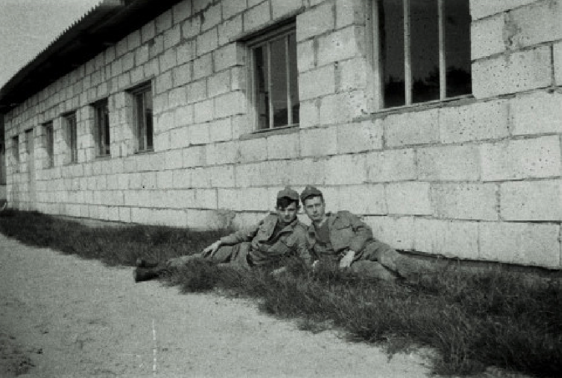
There was also a fenced car park, but without permanent garages or shelters. All the cars were parked in the open air. Throughout the entire period of the airport's operation, 30-35 soldiers were on permanent duty here. Mainly conscript soldiers. Trips to Kąkolewo for conscript soldiers were for a period of two months. No passes or dress uniforms. Professional soldiers went to Kąkolewo for one month. It was similar at other reserve airfields of the remaining regiments. In terms of entertainment, in free time there was a traveling cinema, a TV in the common room, chess, checkers and tricks at a village party.
Although the airport was a backup airport for the 62nd PLM, it also secured the operation of other air units, including the regiments from Wrocław and Sochaczew.
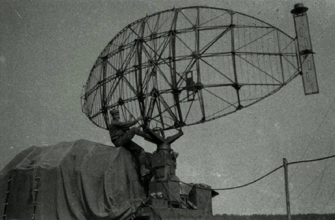
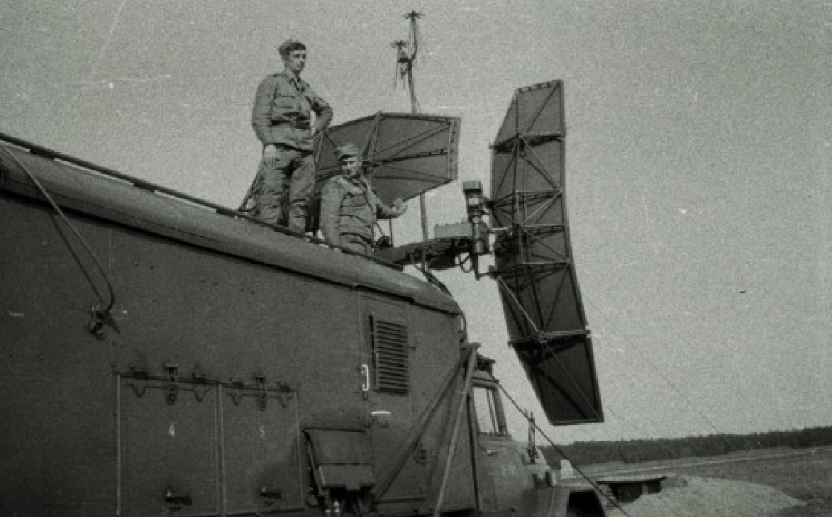
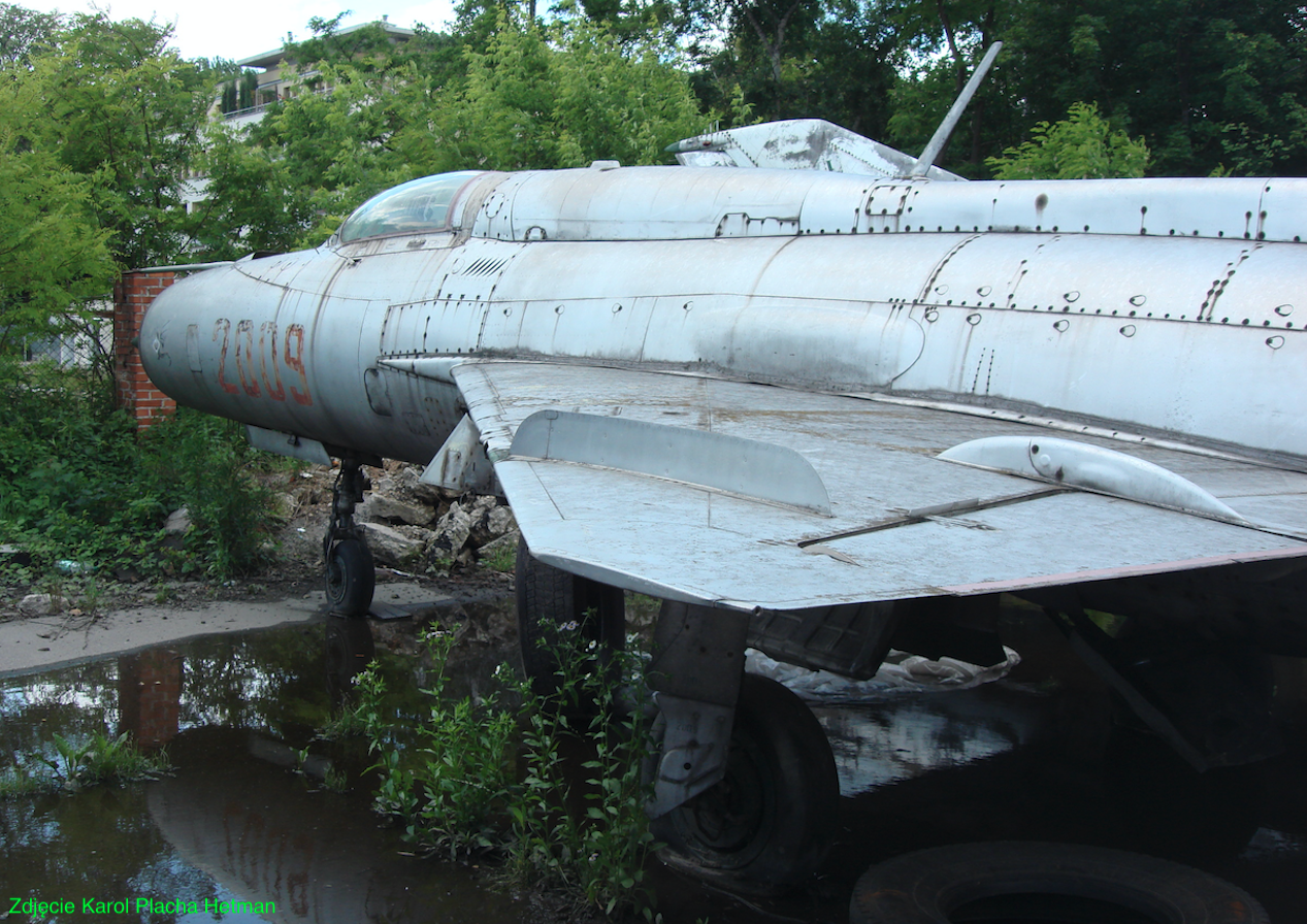
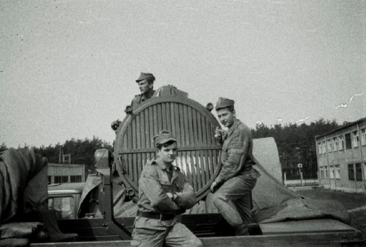
Photo description: Kąkolewo Airport. RSP-7T Blind Landing System, consisting of an airport area control radar station (on a trailer) and a landing approach system (on a car).
Around 1995, the Polish Army stopped using the Kąkolewo airport and gradually withdrew from it. In the new century, farmland was established on the ascent field. In recent years, the airport has become a place for more or less legal car and motorcycle races. In 2008, a tragedy occurred during one of such events. Two motorcyclists died on the spot.
DOL Granowo - road airport section.
DOL Granowo is a complement to the Kąkolewo airport. Granowo is located east of Grodzisk Wielkopolski. National Road No. 32 runs through it. And just about 2,500 m of this road was used as DOL. Currently (2014), few people driving along DK No. 32 know that DOL was here. Others wonder - Why are there two lanes in one direction and only one in the opposite direction? At the eastern end, the parking lot remains of the PPS. There is also a parking lot and a gas station at the western end.
Written by Karol Placha Hetman