Stalowa Wola 2023-03-04
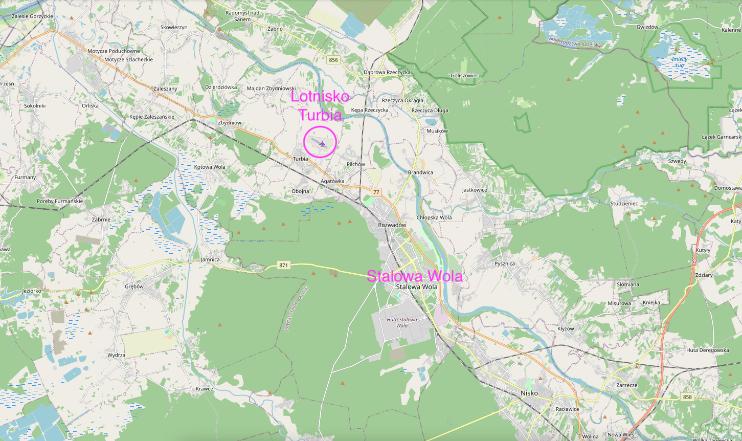
Airport in Turbia near Stalowa Wola.
Geographic coordinates: 50.626N 21.999E. Elevation 150 m.
The city of Stalowa Wola was founded in 1938. City rights were granted on April 1, 1945. The population of the city is 58,545 people (2021). The city of Stalowa Wola was established as an industrial center within the Central Industrial District. Stalowa Wola was established on the land of the village of Pławo and its hamlets of Chyłów and Swołów. The main workplace was the emerging Huta Stalowa Wola, which became a manufacturer of large machines, equipment and armaments for the Polish Army. Stalowa Wola is located in the Podkarpackie Voivodeship, in the Stalowowolskie District. The city is located in the valley of the San River, commonly known as "Nadsanie", between the Janowskie Forests in the north and the Sandomierz Forest in the south-west. Geographically, it is the Sandomierz Basin. Historically, it is the Lesser Poland Land with its center in Sandomierz. The city of Stalowa Wola has an area of 82.52 square kilometers, and the elevation is 150 - 160 m above sea level.
Currently (2023) there has been a renaissance of heavy industry in Stalowa Wola. The plant in Stalowa Wola produces construction machinery (crawler bulldozers, wheel loaders, backhoe loaders) for the Polish Army (artillery equipment, armored cars, engineering equipment).
The following communication routes run through Stalowa Wola: National Road No. 77 Lipnik – Stalowa Wola – Przemyśl. Provincial Road No. 855 Olbięcin - Stalowa Wola. Provincial Road No. 871 Tarnobrzeg – Stalowa Wola.
Stalowa Wola Airport - Turbia.
Geographic coordinates: 54.409N 17.095E. Elevation 150 m.
The airport was established in 1939. The airport has an ICAO code - EPST and an IATA code - QXQ. The distance from the center of Stalowa Wola to the airport is 8.5 km.
The airport was planned as early as 1938 as the airport of the Air and Anti-Gas Defense League. An Organizing Committee was established, to which the Aeroclub of the Republic of Poland promised two RWD-8 aircraft. In 1939, as a social act, the preparation of the landing field in the selected area began. Until the outbreak of World War II, no aircraft flew to the airport. During the occupation, the Germans began to build a reserve airport in 1944, based on Polish plans. It is not known whether the Germans managed to use the airport during the fight against their brothers - the Soviets. After the Second World War, in 1950, an Aviation Center was established here. In 1952, a wooden parachute tower was built. In 1957, the Aero Club of the People's Republic of Poland was established, which is now called Aero Club Stalowa Wola Turbina. The first hangar was built in 1957. The airport building was opened in 1972.
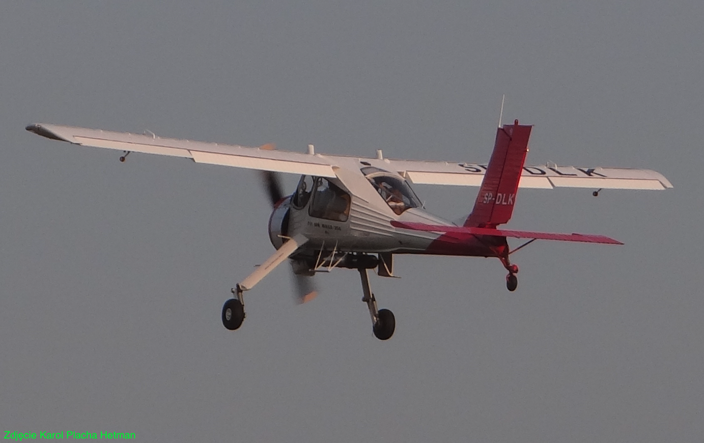
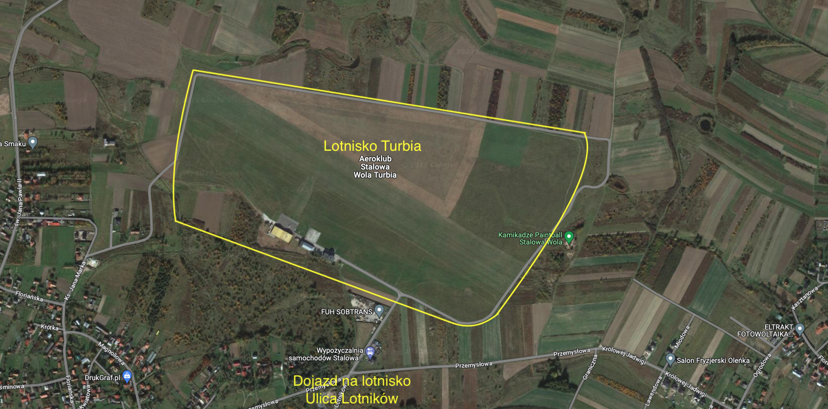
Currently (2023) there are three hangars at the airport, an airport building with a circular tower that is placed on top of the building. There are concrete service levels in front of the hangars. An asphalt access road leads to the airport. The airport is not fenced. There are two runways at the ground airfield. The first RWY with dimensions of 870 m x 100 m in the direction of 121/301. The second RWY with dimensions of 910 m x 100 m, in the direction of 117/297. RWY edges are marked with white rectangles. There is no landing area lighting at the airport. Radio communication Turbia-Radio 120.790 MHz. Powered aircraft make a southerly circle. The gliders make a north circle. The following sections operate in the Aeroclub: ballooning, modelling, airplane and gliding.
Written by Karol Placha Hetman