Piła 2021-04-07
Krępsko fire protection airport near Piła.
Geographic coordinates: 53.249N 16.753E. Elevation 78 m.
History of Krępsko Airport.
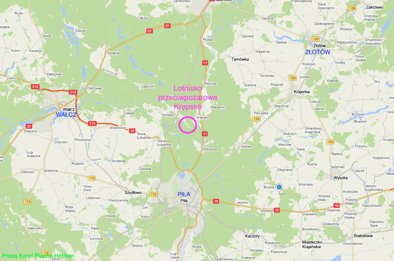
The village of Krępsko is located on the National Road No. 11, on the Piła - Jastrowie section. The village is located on the Rurzyca River, at its confluence with the Gwda River, in the Trzebieskie forests. The village of Krępsko has a population of 300 inhabitants.
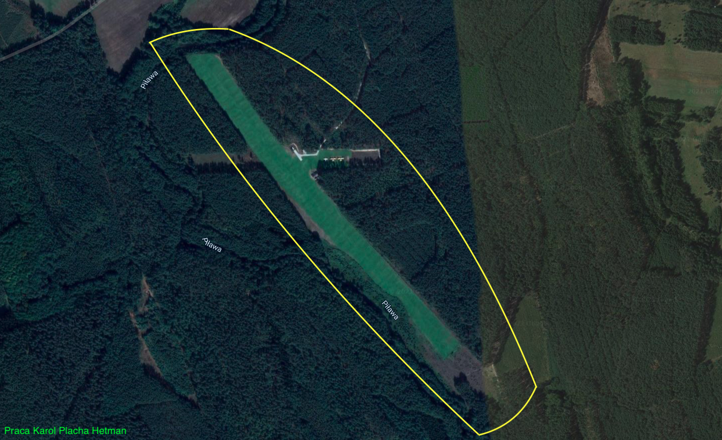
About 3 km from the village, towards the west, in the forest, in the bend of the Piława River, the Krępsko airport is located. The airport has the status of an airstrip. Its coordinates N53°15'01.9" E16°45'06.5". Elevation 230 ft. Radio communication - Base 130.3. Telephone contact +48 604-533-391. Registration number in the Civil Aviation Authority - 156. The airport has a grassy take-off field, very well maintained. RWY is on the 140/320 direction, dimensions 850 m x 70 m.
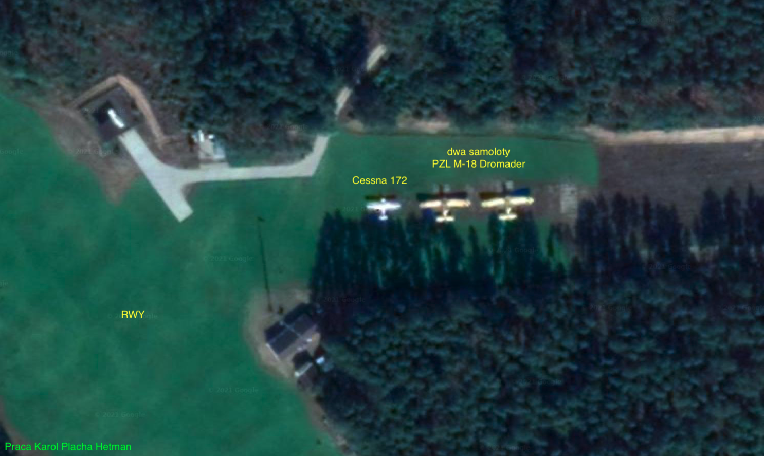
Krzewice Airport is a typical fire protection airport. Of the 20 forest districts belonging to the Regional Directorate of State Forests in Piła, 6 forest units are classified in the highest fire risk category I, and 14 remaining forest units are classified in category II. During direct fire protection action, from dawn to dusk, on weekdays and holidays, a group of several dozen foresters keep watch. They have firefighting vehicles and PZL M-18 Dromader aircraft at their disposal, adapted to fight forest fires. The planes are based at the airport in Krępsk and at the airport in Herburtów, near Krzyż Wielkopolski. Typically, three Dromader PZL M-18-B firefighting planes and one Cessna 172 patrol plane are rented from Aerogryf Aviation.
There are 840 water intake points in the forest areas, various types (natural, artificial and hydrants) and the access roads to these points are marked in a way that allows them to be found quickly and easily in the field.
The factors contributing to the occurrence of forest fires are, in particular, long periods of drought, strong winds, and the main perpetrator is humans. In the area of the Regional Directorate of State Forests in Piła, in 2019, 123 forest fires occurred on an area of 47.84 ha. The average area of one fire was 0.39 ha. Man is the perpetrator of many mindless arsons (burning meadows). In 2019, 27.40 ha of forest burned down as a result of arson. The most tragic year was 1992, when 345 fires were recorded on an area of 5,986 ha, including two disastrous fires in the Notecka Forest: on June 2 - 573 ha and on August 10 - 5,070 ha.
A permanent ground observation network is the primary means of detecting forest fires. This network consists of points, i.e. places from which forest areas can be observed in order to detect fires and provide information about their detection. The observation network of the Regional Directorate of State Forests in Piła consists of 30 fire towers with CCTV. Since 2019, the entire observation network system of the Regional Directorate of State Forests in Piła has been based on HD cameras.
Written by Karol Placha Hetman