Wrocław 2023-02-13
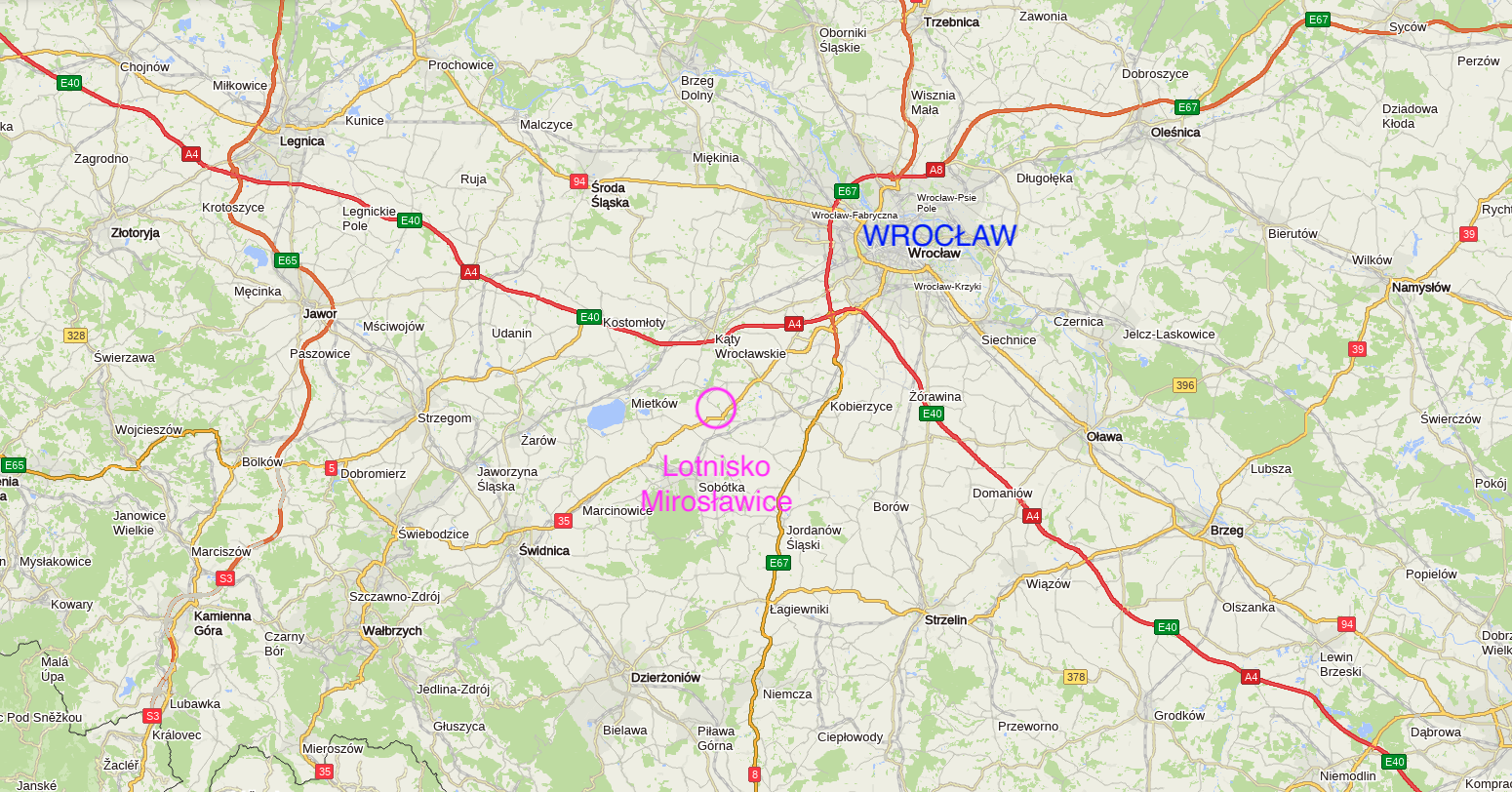
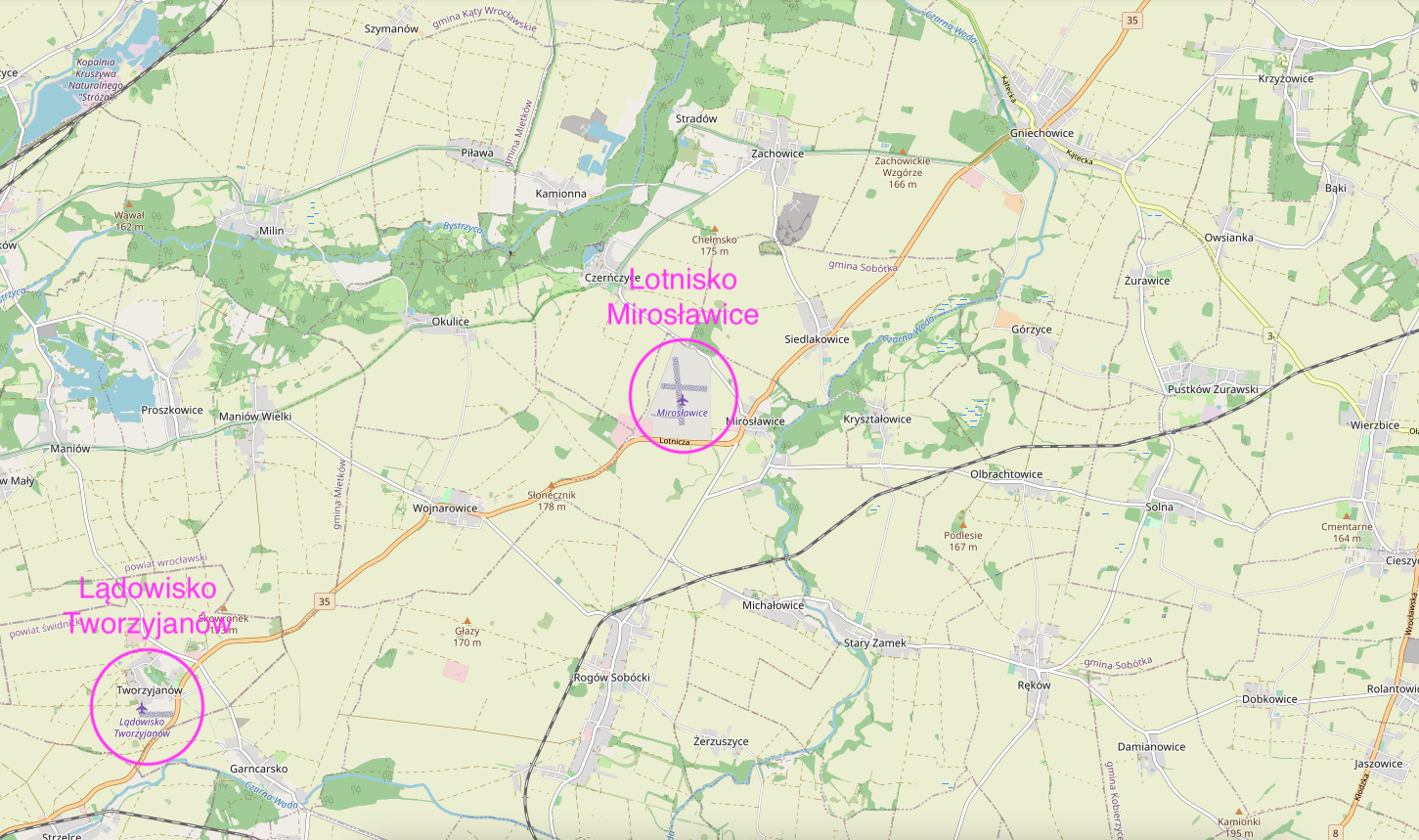
Sports airport in Mirosławice near Wrocław.
Geographic coordinates: 50.958N 16.771E. Elevation 504 ft.
The airport in Mirosławice was established in 1938, when the area belonged to Germans, and the town was called Rosenborn. Unfortunately, stupid Germans, together with their brothers - Muscovites, started another world war. As a result, these areas were granted to Poland by the greats of this world.
A few remarks here. We, the Poles, did not set the borders after World War II. We, the Poles, did not drive the indigenous people from their homes and land. We, the Poles, did not start this cruel war. The Germans have a grudge against the greatest criminals in the history of mankind; Hitler and Stalin, and above all, to themselves. We, the Poles, are the greatest victims of World War II and have lost the most.
In 1938, a year before the outbreak of World War II, an airfield for the Luftwaffe air force was built to the west of the village. In January 1940, the "B20" pilot school for pilots of multi-engine aircraft was installed here. During the war, other aviation schools operated here: "A6", "C13" and "C20".
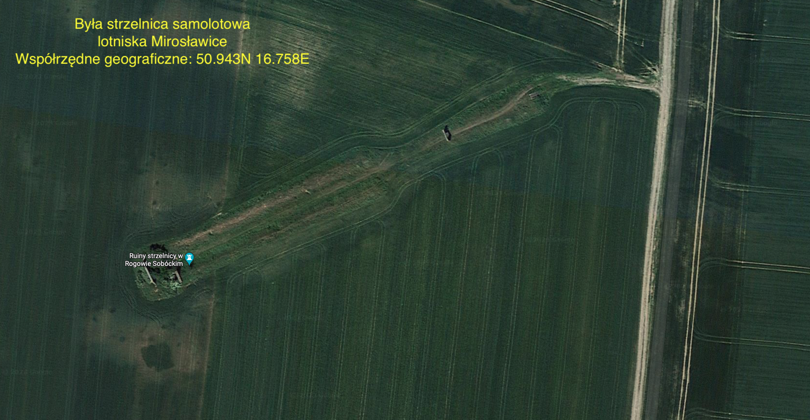
In addition to the landing field, the base had hangars, warehouses, a gas station, barracks for various purposes, a shooting range for on-board weapons. The shooting range was typical for military regulations, so that the shooting distance was 120 m. The ruins of the shooting range are still there (2023). Geographic coordinates: 50.943N 16.758E.
Supply to the airfield was carried out mainly by rail transport - narrow-gauge railway. From the railway line Wrocław - Świdnica, there was a narrow-gauge railway in Rogów Sobótka. The tracks of this railway were mainly used to transport agricultural produce from the vicinity of the village of Wojnarowice. Then they were useful for supplying the Mirosławice airport. The track layout at the airport was extensive. From 1943, the airport operated assembling military aircraft. Wagons that arrived at the airport with aircraft parts were placed in underground shelters. The assembly was carried out in hiding places protected against aerial reconnaissance.
After World War II, the tracks and other railway equipment were dismantled and transported to Moscow. The rest was blown up.
Lower Silesia Aeroclub.
Many years after the war, in 1994, the Aeroclub of Lower Silesia was organized. It was the 50th regional aeroclub registered in Poland. Aviation training began with Jak-12 and PZL An-2 aircraft.
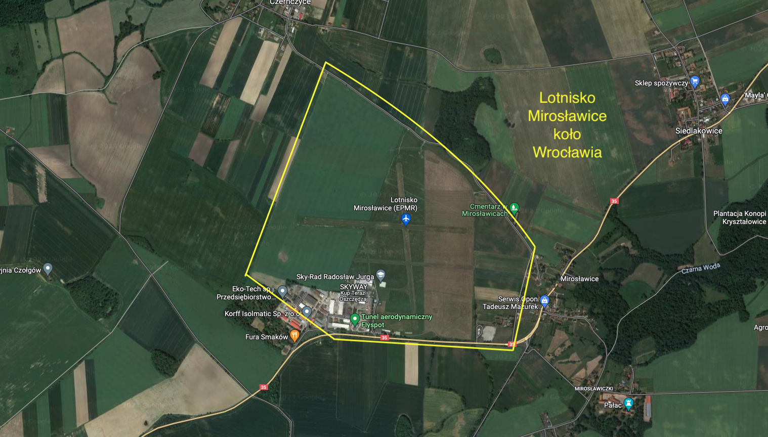
There are two RWYs on the take-off field. The first RWY with dimensions of 800 m x 50 m, in the direction of 17/35. The second RWY with dimensions of 570 m x 50 m, in the direction of 09/27. Each of the RWYs is marked with white marks on the edges of the runways. There is a sleeve of winds near the RWY junction. Aeroclub buildings are located in the south-western part of the airport. There is a petrol station at the airport. Radio communication Miroslawice Radio 122.605 MHz. Address: Lotnicza 14, Mirosławice, 55-059 Sobótka.
Written by Karol Placha Hetman