Lublin 2023-02-11
Airport in Radawiec near Lublin.
Geographic coordinates: 51.223N 22.393E. Elevation 240 m (787 ft).


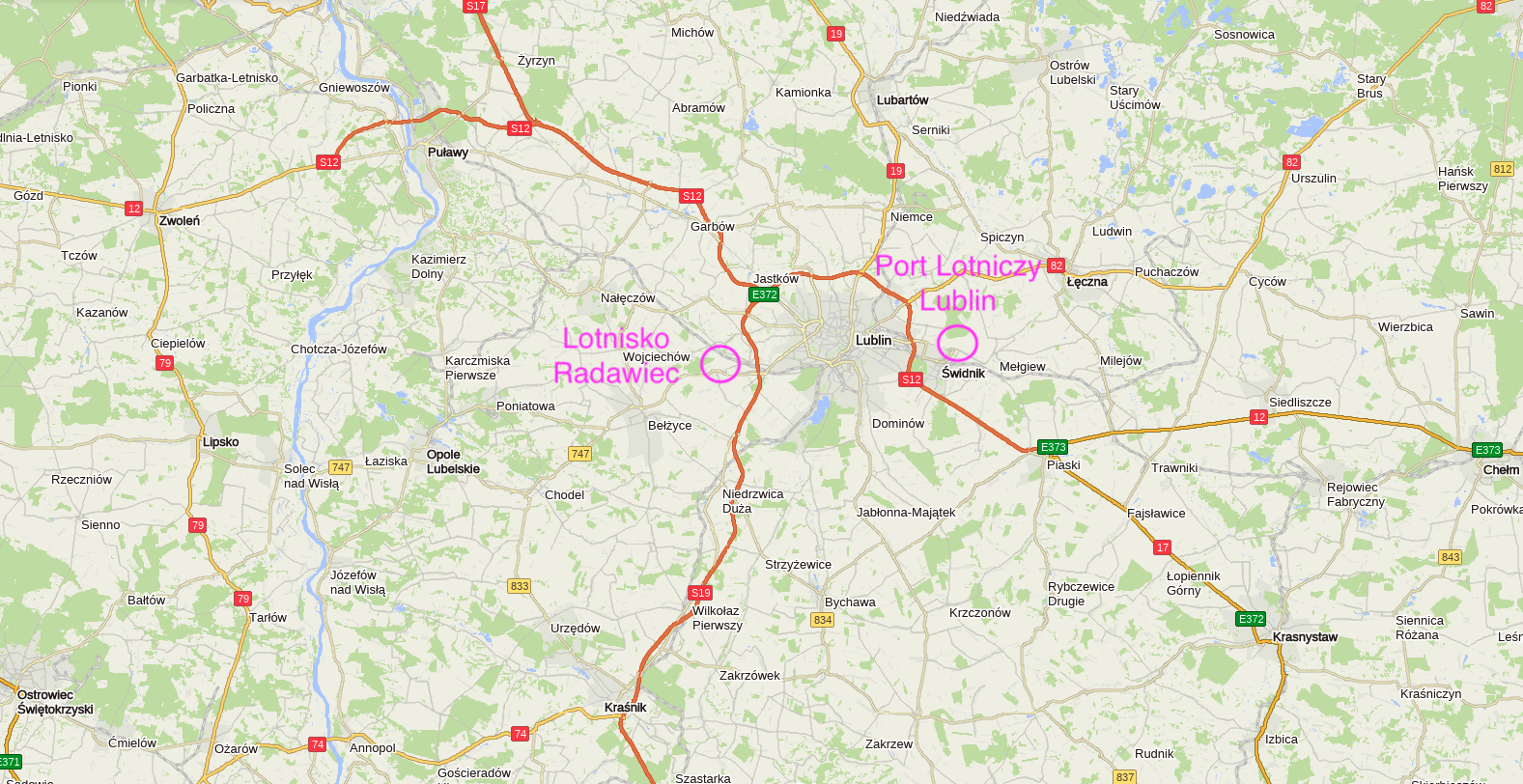
Radawiec Airport is located in the town of Radawiec Duzy in the Lublin Province, in the Lublin District, in the Konopnica Commune. Radawiec airport is located about 10 km south-west of Lublin.
Radawiec Duzy is currently (2023) inhabited by about 1,300 inhabitants who make their living mainly from agriculture. In Radawiec Duzy there is a park, a remnant of the palace park and the remains of a farm complex with a granary and a barn. The first mention of Radawiec comes from 1398. In the 15th century there was an inn and a mill here. As a result of the Third Partition of Poland, the town found itself under Austrian rule. In 1809, it was incorporated into the Duchy of Warsaw, and in 1815, it was in the Congress Poland in the Russian (Moscow) partition. From September 1939 to July 1944, the town was under German occupation within the borders of the General Government. The Germans liquidated the school and the library and burned all the Polish books. At that time, the forests near Radawiec were the place where Poles were murdered by Germans. Today, those events are commemorated by a mass grave. In the period 1975-1998 the town belonged to the Lublin Voivodeship. In 1998, it became part of the new Lubelskie Voivodeship. There is a primary school in Radawiec, which was established in 1916 as the Municipal Elementary School.
Radawiec airport.
Radawiec Airport is used by the Aeroclub of Lublin, Polish Medical Air Rescue and the Border Guard. During the agricultural season, the Airport is used by the Agro-Aviation Services Department.
In August 1944, Radawiec Airport was to be used for shuttle flights to help the Warsaw Uprising. The dictator Stalin initially gave his consent, so special metal nets were delivered to the airport, which increased the carrying capacity of the take-off field and the planes did not sink into the ground. The flights were to be as follows; Aircraft with as much cargo as possible were to arrive from Italy. After dropping support for the Home Army over Warsaw, the planes were to land in Radawiec to refuel and then fly back to Italy. At that time, Radawiec was already under Soviet control. However, Stalin withdrew his consent.
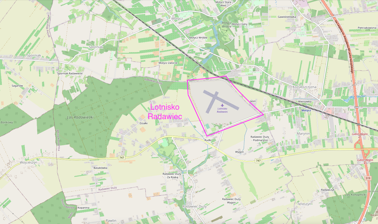
The landing area is a quadrilateral, close to a rectangle, with dimensions of 800 m x 700 m. The airport is limited by municipal roads. It is located between the Lublin-Puławy railway line (No. 7 Dorohusk - Warsaw) from the north and the Provincial Road No. 747. (It connects the National Road No. 9 in Iłża near Radom with the National Road No. 19 in Konopnica near Lublin). Radawiec airport has the status of a civil airport. ICAO-EPLR code. IATA code - QLU. Coordinates 51°13′18″N 22°23′40″E. Elevation 240 m above sea level (787 ft). There are two intersecting runways on the take-off field. First RWY 950 m x 100 m in direction 11/29 (117/297) Often maintained 903 m x 80 m. Second RWY 700 m x 100 m in direction 01/19 or slightly different 544 m x 80 m in direction 02 /20 (026/206). Ground surface - grass. Radio Radawiec-Radio frequency 122.4 MHz. Contact by phone +48 81 5030790. Address Aeroclub of Lublin in Radawiec Radawiec Duży 272A 21-030 Motycz. Polish Medical Air Rescue, 21-030 Motycz, Phone +48 81 5030700.
Due to the numerous users of the Airport, various aircraft can be found there. The Polish Medical Air Rescue uses Eurocopter EC-135 helicopters. The Agricultural Services Department uses PZL M-18 Dromader agricultural aircraft. These planes are often used to extinguish forest fires.
The airport is applying for flight operations also at night. This, however, requires considerable financial outlays. Among them would be a lighting installation.
Within the boundaries of the airport there is a facility of the Institute of Meteorology and Water Management and a sports field of the Konopnica Sports Club. On the take-off field, there is also a designated zone for Radawiec RC models (eastern part of the take-off field).
Written by Karol Placha Hetman
