Biały Bór 2021-01-05
The airport Pieniężnica.
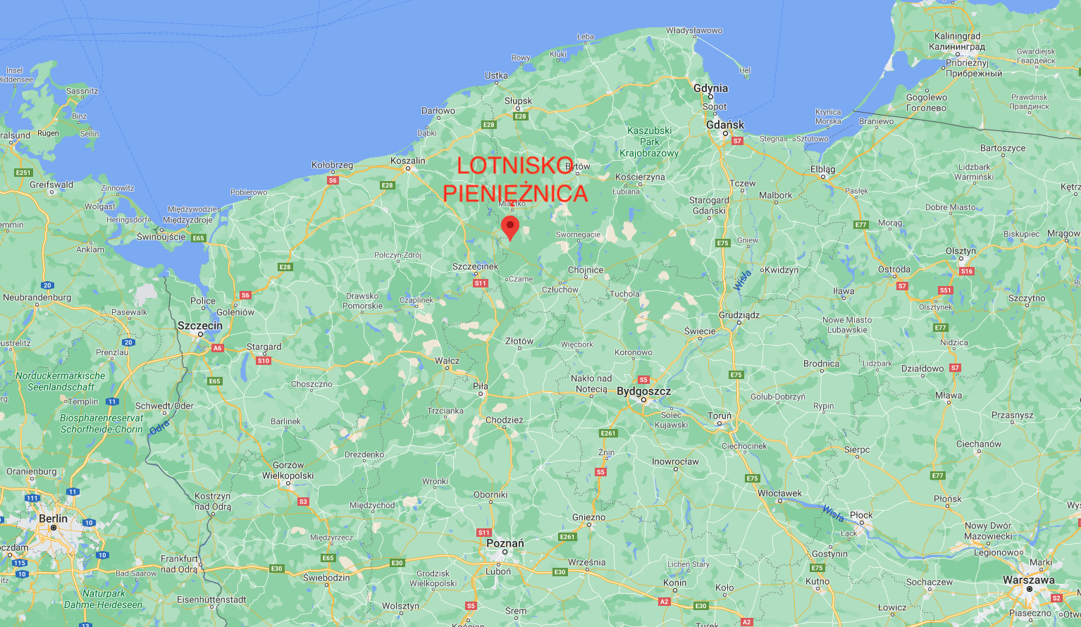
The coordinates of the former Pieniężnica Airport are: 53.871N 16.998E (or 53°52'17.5"N 17°00'11.1"E).


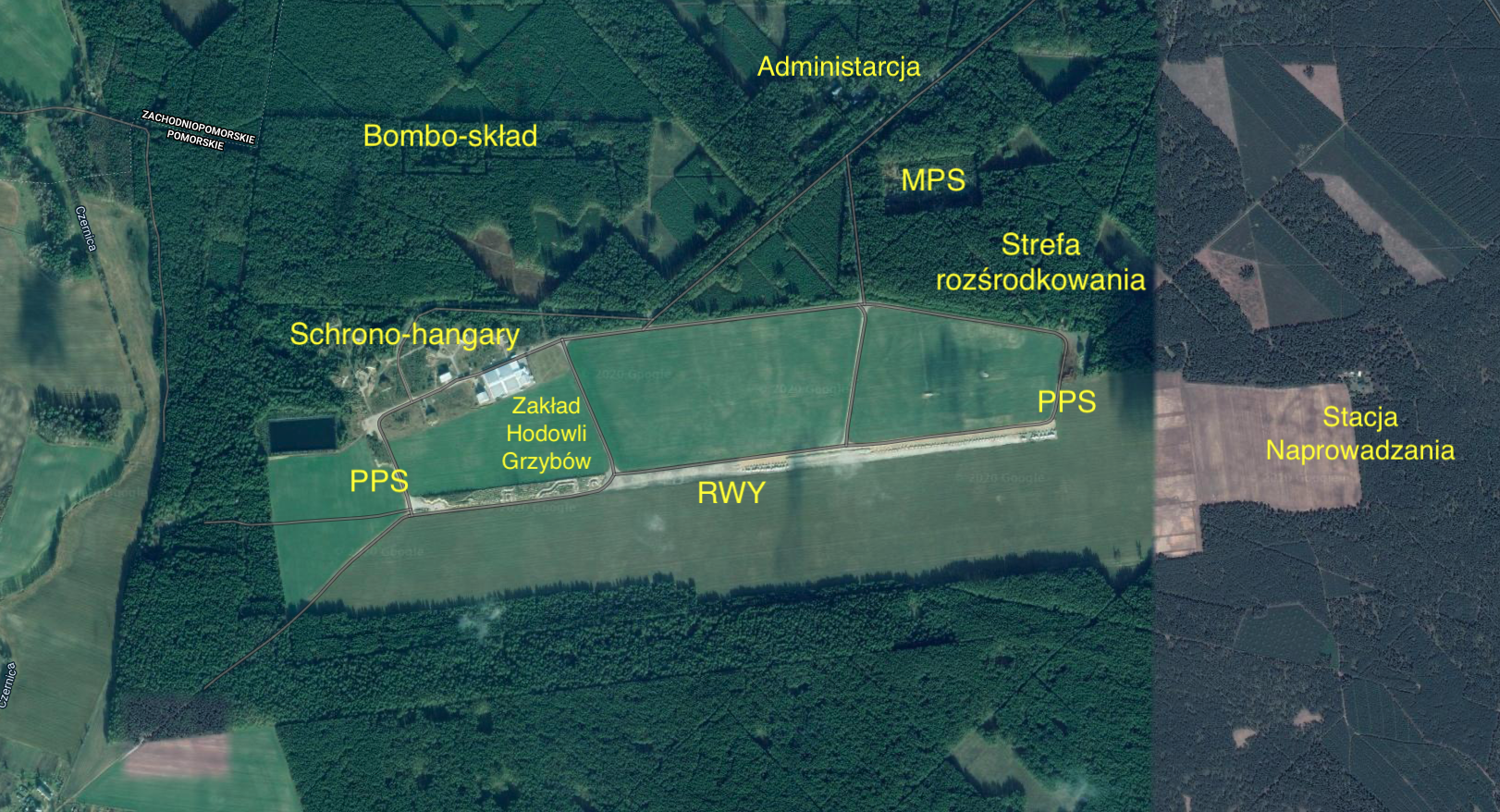
At a distance of about 1,500 m from the village of Pieniężnica, there is an area of the former military airport. Pieniężnica Airport was established in the mid-50s of the 20th century as a typical backup airport for combat regiments of the Polish Army. The layout of the take-off area was typical of airports of the period. RWY with a length of 1,900 m x 40 m, with a concrete surface. RWY was placed in the direction of 084/264, i.e. almost east-west. An emergency runway with a ground surface (grass) has been marked out on the southern side of the RWY. The main taxiway, approximately 2,000 m long, was located on the northern side of the RWY. The main taxiway was connected to the RWY by four connectors. The width of the taxiways was 10-15 m. All taxiways were concrete pavement. PPS (Aircraft Standing Planes), also with a concrete surface, are located at the eastern and western connectors.
There are two centered combat aircraft zones at the airfield. One in the eastern part of the airport (among the trees), and the other in the western part. At the beginning of the 1970s, 10 AU-11 class shelter-hangars were built in the western deployment zone, for Mikojan and Guriewicz MiG-21 aircraft.
The Pieniężnica airport was surrounded by forests on all sides. In the north-eastern part, in the forest, there is an MPS (depot of fuels and lubricants, with full equipment) and administration and barracks buildings of the airport. In the north-western part, in the forest, a bomb depot (a warehouse for armaments for aircraft) was placed.
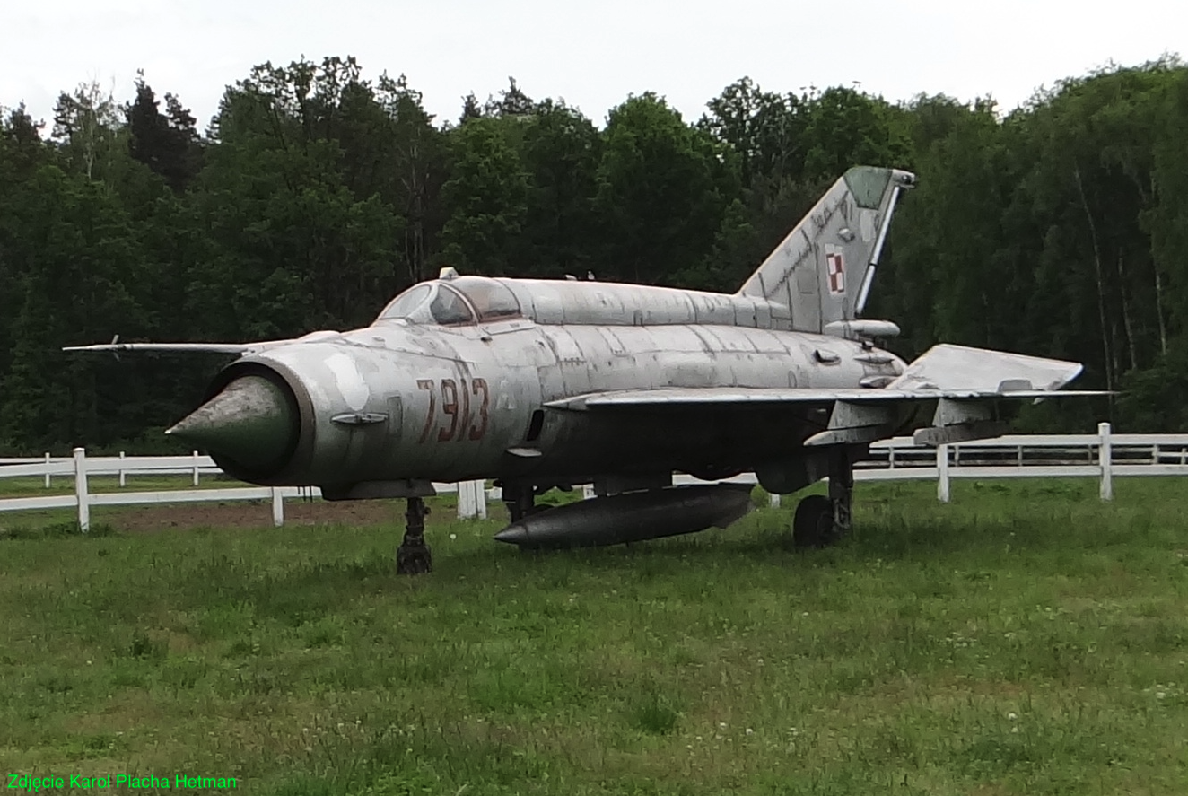
Pieniężnica Airport did not have a permanent host. Regiments such as the 6th PLM from Piła, the 26th PLM from Zegrze Pomorskie, the 28th PLM from Słupsk, the 41st PLM from Malbork and others were based here temporarily. The following aircraft landed at the airport: MiG-21, MiG-23, TS-8 Bies, TS-11 Iskra.
Already at the end of the 80s, the airport was underinvested and fell into degradation. At that time, there was already an excess of military airports in relation to needs. Since the 90s, planes have landed here sporadically. Probably the last landing of a civilian plane took place in 2004. At that time, a Cessna 172 aircraft made an emergency landing. At that time, only the eastern part of the RWY, at a length of 1,000 m, was fit for landing.
The Pieniężnica Airport was located entirely in the Pomeranian Voivodeship in the Człuchów District. Postcode 77-306. But the border of the village of Koczała and village of Pieniężnica runs through the airport. Most of the area is in the village of Pieniężnica. In the Koczała Commune there is the eastern part of the take-off field, the area of the former MPS and administrative and barracks facilities.
In the 1990s, the airport was taken over by the Military Property Agency and put up for sale, without the need to maintain its aviation character. Legal and illegal car and motorcycle races were organized at the airport. In 2019, the trustee managing the assets of the former airport dismantled the remaining part of RWY, taxiways and shelter-hangars. In part of the field of ascents, there is currently (2020) a plant growing edible mushrooms; mushrooms and oyster mushrooms.
In 2020, 359 people lived in the village of Pieniężnica. It was 9.5% of the inhabitants of the Rzeczenica Commune. The area of Pieniężnica is mainly forests, arable fields and wastelands, because the soils are not of the highest quality. The Czernica River flows nearby, over which there was a medieval settlement. In the village of Pieniężnica there is a post-Protestant church under the challenge of St. Martin, which was built in the years 1814-1817. The church has walls made of "timbered masonry". During the People's Republic of Poland, the State Agricultural Farm "PGR" operated in Pieniężnica.
Pieniężnica Airport also had other names. Biały Bór Airport, because it is the largest city nearby. Koczała airport, because the main access to the airport was from the village of Koczała, via a concrete road. There is only a dirt road from the side of Pieniężnica and it led through the farm gate to the take-off field itself.
DOL on National Road No. 25.
At a distance of about 5 km from the Pieniężnica Airport, there is the National Road No. 25, on the Biały Bór - Rzeczenica section. DOL Brzezie is located on this road, in the town of Brzezie. National Road No. 25 is 412 km long. The road runs from north to south. It runs through the following voivodeships: Zachodniopomorskie, Pomorskie, Kujawsko-Pomorskie, Wielkopolskie and Dolnośląskie.
Train to Pieniężnica Airport.

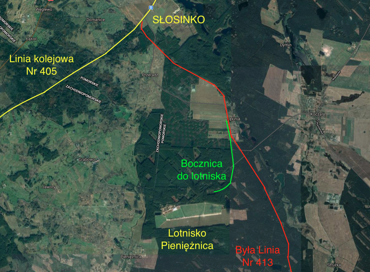
Currently, there is a railway line No. 405, which connects Piła with Ustka, via Szczecinek, Biały Bór, Miastko and Słupsk, with a length of 193.67 km. To the north-east of Biały Bór is the Słosinko railway station. The Słosinko-Cłuchów railway line, No. 413 and a length of about 55 km, ran from this station. The trail ran through the following villages: Łękinai, Koczała Bielsk Pomorski, Nowa Brda, Nowa Wieś Człuchowska, Przechlewo, Sąpolno, Człuchów Czosnowo, Polnica, Kiełpin. This trail was launched in 1902. The Łękinia railway station was located on this route. Around 1955, a railway siding was built from Łękinia station to Pieniężnica Airport, with a length of about 4,000 m. In 1991, railway line No. 413 was closed and was gradually dismantled. In 2006, line No. 413 was completely dismantled, together with the railway siding to the Pieniężnica Airport, on the Słosinko - Przechlewo section. On the section Przechlewo - Człuchów, the tracks remain, but they are not used.
Written by Karol Placha Hetman
